Latitude: 52.9129 / 52°54'46"N
Longitude: -3.594 / 3°35'38"W
OS Eastings: 292908
OS Northings: 336242
OS Grid: SH929362
Mapcode National: GBR 6D.NHH2
Mapcode Global: WH675.R1RQ
Plus Code: 9C4RWC74+5C
Entry Name: Pont-y-Bala
Listing Date: 19 October 1951
Grade: II
Source: Cadw
Source ID: 4908
Building Class: Transport
ID on this website: 300004908
Location: Spanning the river Dee and carrying the main road at the NE approach to the town. Also listed in Llandderfel Community.
County: Gwynedd
Town: Bala
Community: Bala (Y Bala)
Community: Bala
Built-Up Area: Bala
Traditional County: Merionethshire
Tagged with: Architectural structure
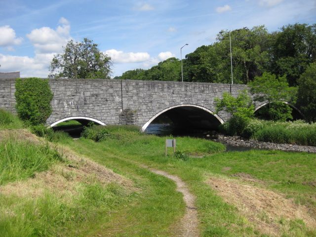
Road bridge, probably of C17 origin, and presumably that shown in a sketch of Bala by Thomas Dinley in 1684. The bridge has been doubled in width on the downriver side within the last few decades.
Long road bridge of rough-dressed rubble construction, snecked to the downriver side. The bridge has 4 segmental arches recessed below archrings of narrow stones; half-height triangular cutwaters to both sides, continuing to parapet height as shallow pilasters on the downriver side. Flat carriageway and plain, coped parapets. Cemented arch soffits; 3 pairs of modern street lights.
Listed as an imposing bridge of C17 origin, historically the main approach to the town of Bala.
External links are from the relevant listing authority and, where applicable, Wikidata. Wikidata IDs may be related buildings as well as this specific building. If you want to add or update a link, you will need to do so by editing the Wikidata entry.


Other nearby listed buildings