Latitude: 52.742 / 52°44'31"N
Longitude: -3.8866 / 3°53'11"W
OS Eastings: 272734
OS Northings: 317710
OS Grid: SH727177
Mapcode National: GBR 90.0CQN
Mapcode Global: WH56P.8BHR
Plus Code: 9C4RP4R7+Q9
Entry Name: Heulwen
Listing Date: 19 June 1990
Last Amended: 19 June 1990
Grade: II
Source: Cadw
Source ID: 4977
Building Class: Domestic
ID on this website: 300004977
Location: On the street line near the junction with Well Street.
County: Gwynedd
Community: Dolgellau
Community: Dolgellau
Built-Up Area: Dolgellau
Traditional County: Merionethshire
Tagged with: Building
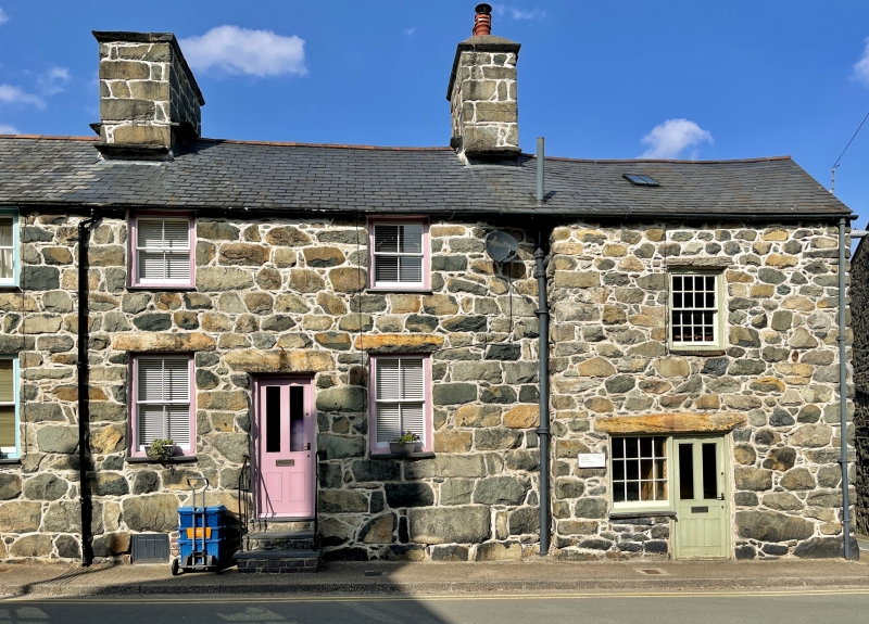
cl800.
Reflected pair of 2 storey and cellar, 2 window houses. Coursed rubble masonry. Moderately pitched slate roof, plain close eaves. Deep rectangular stone stacks, simply moulded caps, stone water tabling.
Shallow sash windows without glazing bars set under eaves. Similar larger windows to ground floors, stone lintel. Central doorways, stone lintels, modern doors. Slate steps down to street with contemporary plain iron side rails. Small cellar opening to left of steps.
Group value.
External links are from the relevant listing authority and, where applicable, Wikidata. Wikidata IDs may be related buildings as well as this specific building. If you want to add or update a link, you will need to do so by editing the Wikidata entry.


Other nearby listed buildings