Approximate Location Map
Large Map »
Latitude: 52.746 / 52°44'45"N
Longitude: -3.8863 / 3°53'10"W
OS Eastings: 272768
OS Northings: 318155
OS Grid: SH727181
Mapcode National: GBR 90.05SH
Mapcode Global: WH56P.87MP
Plus Code: 9C4RP4W7+CF
Entry Name: Dolgellau Primary School
Listing Date: 19 June 1990
Last Amended: 19 June 1990
Grade: II
Source: Cadw
Source ID: 5055
Building Class: Education
ID on this website: 300005055
Location: Situated on rising ground immediately to the W of the Council Offices.
County: Gwynedd
Community: Dolgellau
Community: Dolgellau
Built-Up Area: Dolgellau
Traditional County: Merionethshire
Tagged with: School building
l9l5.
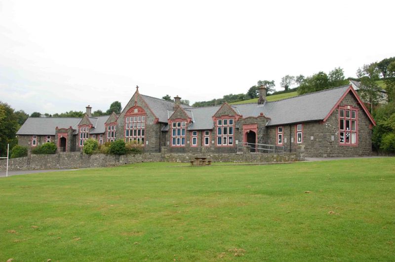
Single storey school building in a long gabled range with outer wings inclined forward. Snecked rubble masonry with red sandstone dressings. Steeply pitched slate roofs, oversailing eaves, deep verges, bargeboards. Angular stone stacks set on square bases - removed to outer ends.
Advanced gabled centre bay, raking gable parapets on kneelers, finial. Large 20 pane mullioned and transomed window, segmental pediment with Welsh motto, centre missing. Two 9 pane mullioned and transomed windows raised into gablets flanking to each side; gable parapets, kneelers 2 transomed single light windows set between.
Porches set to angles where outer wings come forward. Parapets with ball finials. Tudor doorways, decorated spandrels below lettering, GENETHOD to porch on left, BECHGYN to right. Radial fanlights over half-glazed inner double doors. Two transomed single light windows to outer wings. 9 pane mullioned end transomed windows to end elevations.
Three cross ranges to rear, lateral stacks to that to centre. 3 light transomed windows. Rear yard closed off by outbuildings and screen wall with Tudor archway, crow stepped gables.
Retaining wall to front of school, rubble with square piers, contemporary ball pointed railings. Yards to front bounded by rubble walls with piers rising to support ball pointed railings with dogbars.
External links are from the relevant listing authority and, where applicable, Wikidata. Wikidata IDs may be related buildings as well as this specific building. If you want to add or update a link, you will need to do so by editing the Wikidata entry.


Other nearby listed buildings
