Approximate Location Map
Large Map »
Latitude: 51.9438 / 51°56'37"N
Longitude: -3.3863 / 3°23'10"W
OS Eastings: 304809
OS Northings: 228167
OS Grid: SO048281
Mapcode National: GBR YP.MNPK
Mapcode Global: VH6BZ.8D5P
Plus Code: 9C3RWJV7+GF
Entry Name: Canal Bridge at S end of Gasworks Lane
Listing Date: 16 December 1976
Last Amended: 4 November 2005
Grade: II
Source: Cadw
Source ID: 6888
Building Class: Transport
ID on this website: 300006888
Location: Carries Gasworks lane over Canal.
County: Powys
Town: Brecon
Community: Brecon (Aberhonddu)
Community: Brecon
Built-Up Area: Brecon
Traditional County: Brecknockshire
Tagged with: Bridge
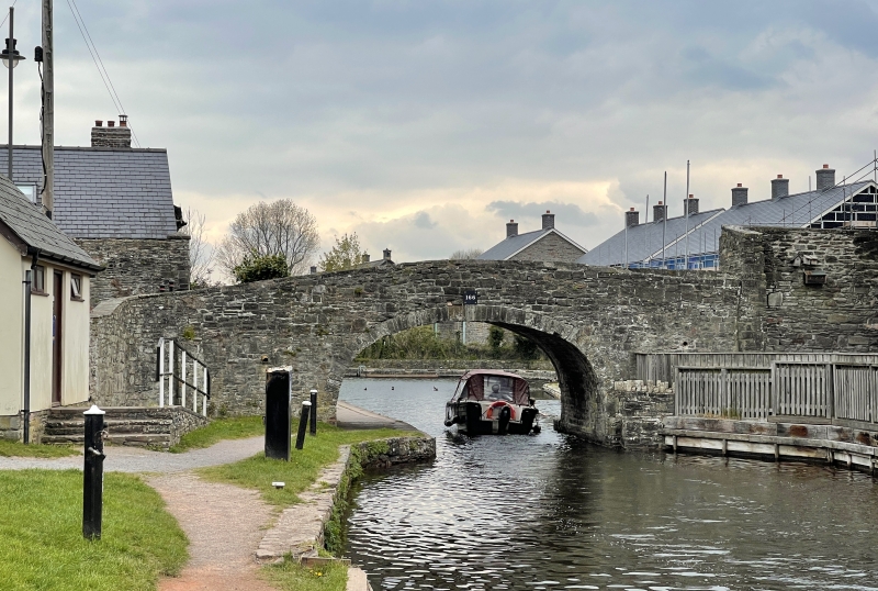
Probbaly from earliest phase of canal; 1796 to 1800.
Arched bridge of stone rubble with parapet; iron plate with number 166.
Well-preserved late C18 canal bridge, illustrating transport history.
External links are from the relevant listing authority and, where applicable, Wikidata. Wikidata IDs may be related buildings as well as this specific building. If you want to add or update a link, you will need to do so by editing the Wikidata entry.


Other nearby listed buildings
