Approximate Location Map
Large Map »
Latitude: 51.9469 / 51°56'48"N
Longitude: -3.3887 / 3°23'19"W
OS Eastings: 304649
OS Northings: 228508
OS Grid: SO046285
Mapcode National: GBR YP.MG2Y
Mapcode Global: VH6BZ.6BWC
Plus Code: 9C3RWJW6+PG
Entry Name: Boundary Wall to the Rear of the Plough United Reformed Church, and Police Station
Listing Date: 16 December 1976
Last Amended: 4 November 2005
Grade: II
Source: Cadw
Source ID: 6946
Building Class: Religious, Ritual and Funerary
ID on this website: 300006946
County: Powys
Town: Brecon
Community: Brecon (Aberhonddu)
Community: Brecon
Built-Up Area: Brecon
Traditional County: Brecknockshire
Tagged with: Wall
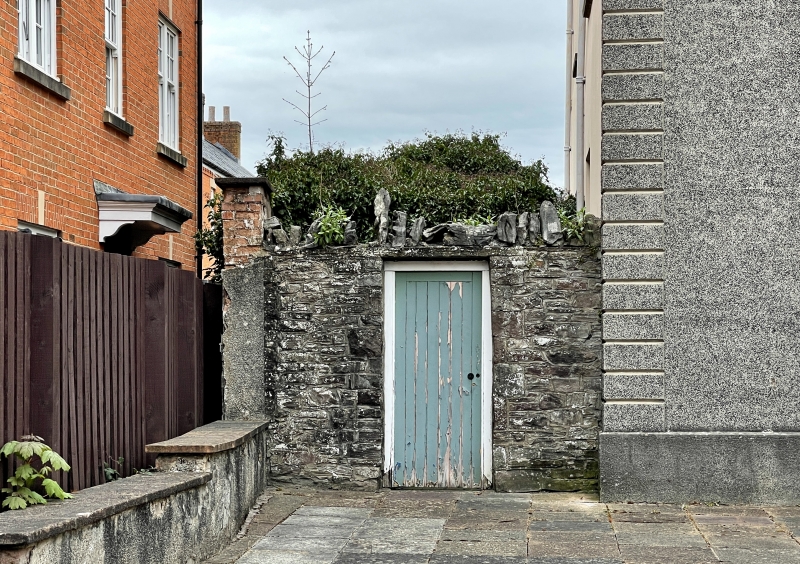
Probably late C18 or early C19.
High wall of stone probably following the course of the medieval town wall; present structure above ground probably of C18 to C19 date. Now broken down in places towards SE end.
A late C18 or early C19 wall on line of medieval defences of Brecon.
External links are from the relevant listing authority and, where applicable, Wikidata. Wikidata IDs may be related buildings as well as this specific building. If you want to add or update a link, you will need to do so by editing the Wikidata entry.


Other nearby listed buildings
