Latitude: 51.9504 / 51°57'1"N
Longitude: -3.3909 / 3°23'27"W
OS Eastings: 304501
OS Northings: 228904
OS Grid: SO045289
Mapcode National: GBR YP.M7HX
Mapcode Global: VH6BZ.57PN
Plus Code: 9C3RXJ25+5J
Entry Name: Priory Bridge
Listing Date: 16 December 1976
Last Amended: 4 November 2005
Grade: II
Source: Cadw
Source ID: 7012
Building Class: Transport
ID on this website: 300007012
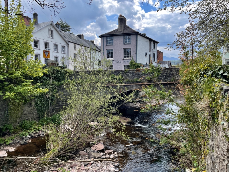
Location: Spanning the River Honddu at foot of Priory Hill.
County: Powys
Town: Brecon
Community: Brecon (Aberhonddu)
Community: Brecon
Built-Up Area: Brecon
Traditional County: Brecknockshire
Tagged with: Bridge Road bridge
Probably mid C19; once a bridge of 2 spans. Although shown in similar form in a watercolour of the Struet by J M Ince, dated 1850 in National Library of Wales, possibly a rebuilding after the great flood of the Honddu in 1853.
Bridge of stone with single wide segmental arch and stone parapet with flat stone coping.
Listed for Group Value with buildings in Priory Hill, The Struet, and the Cathedral precinct.
External links are from the relevant listing authority and, where applicable, Wikidata. Wikidata IDs may be related buildings as well as this specific building. If you want to add or update a link, you will need to do so by editing the Wikidata entry.


Other nearby listed buildings