Approximate Location Map
Large Map »
Latitude: 51.9501 / 51°57'0"N
Longitude: -3.3908 / 3°23'26"W
OS Eastings: 304512
OS Northings: 228866
OS Grid: SO045288
Mapcode National: GBR YP.M7L7
Mapcode Global: VH6BZ.57SX
Plus Code: 9C3RXJ25+2M
Entry Name: 17 The Struet
Listing Date: 31 May 1961
Last Amended: 4 November 2005
Grade: II
Source: Cadw
Source ID: 7048
Building Class: Domestic
ID on this website: 300007048
Location: About 30 metres S of junction with King Street.
County: Powys
Town: Brecon
Community: Brecon (Aberhonddu)
Community: Brecon
Built-Up Area: Brecon
Traditional County: Brecknockshire
Tagged with: Building
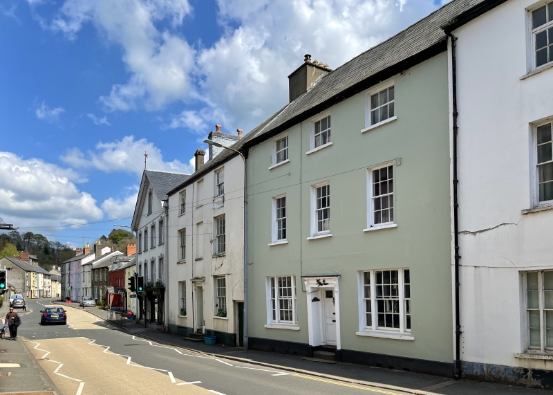
Probably early C19.
House. Three storeys, three window front; stucco; plinth. Slate roof. On top floor, 6-pane casement windows. On first floor, three 12-pane sash windows. On ground floor, central doorway with bracketed cornice; 6-panelled door (top panels glazed). To each side, a tripartite sash window with small-pane glazing.
Interior similar to No.16.
Well-preserved Georgian house. Group value.
External links are from the relevant listing authority and, where applicable, Wikidata. Wikidata IDs may be related buildings as well as this specific building. If you want to add or update a link, you will need to do so by editing the Wikidata entry.


Other nearby listed buildings
