Approximate Location Map
Large Map »
Latitude: 51.951 / 51°57'3"N
Longitude: -3.3898 / 3°23'23"W
OS Eastings: 304582
OS Northings: 228974
OS Grid: SO045289
Mapcode National: GBR YP.M7SG
Mapcode Global: VH6BZ.6795
Plus Code: 9C3RXJ26+C3
Entry Name: 45 The Struet
Listing Date: 16 December 1976
Last Amended: 4 November 2005
Grade: II
Source: Cadw
Source ID: 7057
Building Class: Domestic
ID on this website: 300007057
Location: Opposite former brewery, where building line stops on opposite side of The Struet.
County: Powys
Town: Brecon
Community: Brecon (Aberhonddu)
Community: Brecon
Built-Up Area: Brecon
Traditional County: Brecknockshire
Tagged with: Building
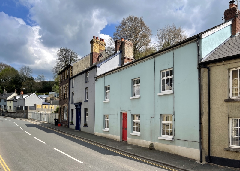
Earlier C19. Formerly 2 houses with 2 doorways and central passage.
Two storey house with 3-window front; smooth render with plinth; slate roof. Asymmetrical front with roughly central doorway (modern panelled door). On each floor, single window to L of doorway, and two to R. Modern small-pane casement glazing.
Included for Group Value with adjacent listed buildings in The Struet.
External links are from the relevant listing authority and, where applicable, Wikidata. Wikidata IDs may be related buildings as well as this specific building. If you want to add or update a link, you will need to do so by editing the Wikidata entry.


Other nearby listed buildings
