Approximate Location Map
Large Map »
Latitude: 52.0749 / 52°4'29"N
Longitude: -3.1241 / 3°7'26"W
OS Eastings: 323053
OS Northings: 242429
OS Grid: SO230424
Mapcode National: GBR F1.CFP3
Mapcode Global: VH6BJ.S3RR
Plus Code: 9C4R3VFG+W9
Entry Name: Half Moon House
Listing Date: 1 February 1988
Last Amended: 1 February 1988
Grade: II
Source: Cadw
Source ID: 7383
Building Class: Commercial
ID on this website: 300007383
County: Powys
Community: Hay (Y Gelli Gandryll)
Community: Hay
Built-Up Area: Hay-on-Wye
Traditional County: Brecknockshire
Tagged with: Architectural structure
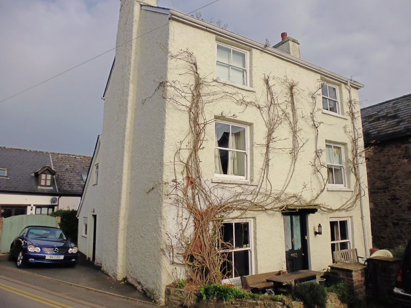
At the E end of an island site at the junction with Chancery Lane and facing down the street; small rubble walled forecourt. Formerly a public house.
C18 3-storey, 2-window roughcast front with slate roof and rubble end brick chimney stacks. Horned 4-pane sash windows separated either side of central entrance with modern door. Casement and sash windows on right end; exposed chimney breast on left end and modern lean-to at rear.
Interior altered in conversion to office use.
External links are from the relevant listing authority and, where applicable, Wikidata. Wikidata IDs may be related buildings as well as this specific building. If you want to add or update a link, you will need to do so by editing the Wikidata entry.


Other nearby listed buildings
