Approximate Location Map
Large Map »
Latitude: 52.0713 / 52°4'16"N
Longitude: -3.131 / 3°7'51"W
OS Eastings: 322572
OS Northings: 242042
OS Grid: SO225420
Mapcode National: GBR F0.CRZ2
Mapcode Global: VH6BJ.P63G
Plus Code: 9C4R3VC9+GH
Entry Name: Cockcroft House (former Hay Union Workhouse)
Listing Date: 1 February 1988
Last Amended: 1 February 1988
Grade: II
Source: Cadw
Source ID: 7413
Building Class: Domestic
ID on this website: 300007413
Location: Reached down a short drive; faces SW behind Church Terrace.
County: Powys
Community: Hay (Y Gelli Gandryll)
Community: Hay
Built-Up Area: Hay-on-Wye
Traditional County: Brecknockshire
Tagged with: Workhouse
Built 1837 for the Hay poor Law Union which was formed 26th September 1836 comprising 25 parishes;
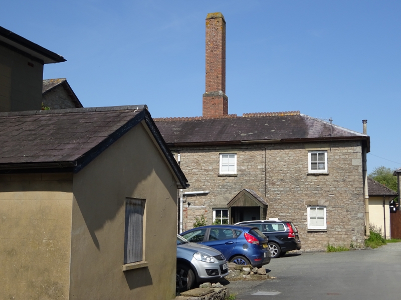
Modern conversion to housing. Standard grid plan form with transverse and spinal ranges linked by central octagonal block. Classical 8-bay freestone front with extensions to either end, central 2 bays advanced and gabled with plaque reading H U 1837; cill band and rusticated bull nosed plinth. Slate roof with cresting and wide eaves with brackets to gable. Voussoir lintels to small pane sash windows, all replaced; one window to right converted into a doorway and vice versa to centre. Bracket cornices to central doorways. 2-storey modern extension to left (No.1) with upper floor set back and with implied blocked windows; cement render right hand extension slightly set back with sash windows.
Rubble walled courtyards to N and S much modernised; casement windows with lintels. 3-storey octagon with 4-light pivot windows to flanking N and S ranges, brick chimney stacks including one that is especially tall. Single storey range with similar detail extends to E from octagon with louvred gablet dormers, also to lower attached hipped roof range at NE.
External links are from the relevant listing authority and, where applicable, Wikidata. Wikidata IDs may be related buildings as well as this specific building. If you want to add or update a link, you will need to do so by editing the Wikidata entry.


Other nearby listed buildings
