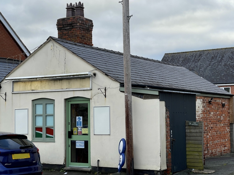
10, Lower Canal Road, Powys
A Grade II Listed Building in Newtown and Llanllwchaiarn (Y Drenewydd a Llanllwchaearn), Powys
Coordinates
Latitude: 52.5165 / 52°30'59"N
Longitude: -3.3089 / 3°18'31"W
OS Eastings: 311278
OS Northings: 291760
OS Grid: SO112917
Mapcode National: GBR 9S.GJ0Z
Mapcode Global: VH689.L0LP
Plus Code: 9C4RGM8R+HC
Entry Name: 10, Lower Canal Road, Powys
Listing Date: 9 May 1988
Grade: II
Source: Cadw
Source ID: 8133
Building Class: Domestic
ID on this website: 300008133
Location: On the street line near the junction of Lower Canal Road with Dolafon Road.
County: Powys
Community: Newtown and Llanllwchaiarn (Y Drenewydd a Llanllwchaearn)
Community: Newtown and Llanllwchaiarn
Built-Up Area: Newtown
Traditional County: Montgomeryshire
Tagged with:
Building
History
Associated with the former Canal Basin.
Reasons for Listing
Group value.
External Links
External links are from the relevant listing authority and, where applicable, Wikidata.
Wikidata IDs may be related buildings as well as this specific building. If you want to add or update a link, you
will need to do so by editing the Wikidata entry.
Recommended Books
Other nearby listed buildings
-
II
11, Lower Canal Road, Powys
On the street line near the junction of Lower Canal Road with Dolafon Road.
-
II
8, Lower Canal Road, Powys
On the street line near the junction of Lower Canal Road with Dolafon Road.
-
II
7, Lower Canal Road, Powys
On the street line near the junction of Lower Canal Road with Dolafon Road.
-
II
6, Lower Canal Road, Powys
On the street line near the junction of Lower Canal Road with Dolafon Road.
-
II
5, Lower Canal Road, Powys
On the street line near the junction of Lower Canal Road with Dolafon Road.
-
II
4, Lower Canal Road, Powys
On the street line near the junction of Lower Canal Road with Dolafon Road.
-
II
Cambrian House
Set behind a small front garden at the junction of Mill Close with Lower Council Road.
-
II
NO.8 SEVERN SQUARE, Newtown, POWYS
Set back from the street line. Stepped up from No 7 adjoining and facing Gas Street.