Latitude: 52.3503 / 52°21'1"N
Longitude: -3.0664 / 3°3'59"W
OS Eastings: 327457
OS Northings: 273003
OS Grid: SO274730
Mapcode National: GBR B3.T3Q6
Mapcode Global: VH76N.S6R3
Plus Code: 9C4R9W2M+4C
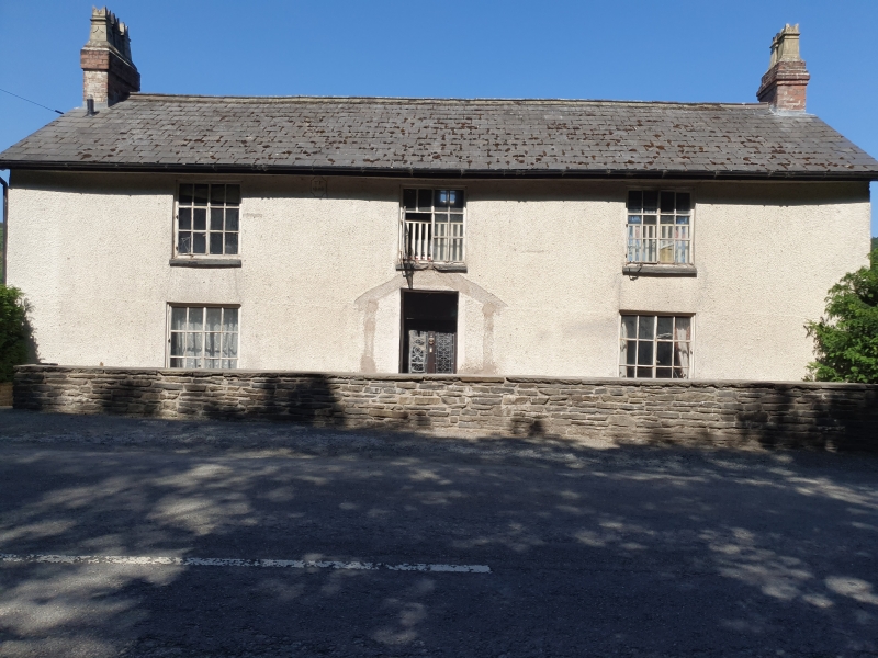
Entry Name: Halfway House
Listing Date: 30 September 1985
Last Amended: 30 September 1985
Grade: II
Source: Cadw
Source ID: 9033
Building Class: Domestic
ID on this website: 300009033
Location: At the roadside with ground falling away steeply to rear.
County: Powys
Community: Knighton (Tref-y-clawdd)
Community: Knighton
Locality: Garth
Traditional County: Radnorshire
Tagged with: Architectural structure
Dated 1848.
2-storey 3-window symmetrical roughcast front. Extra storey to rear. Slate roof, swept low to rear with dog-leg profile, boxed eaves, plain bargeboards, 2 brick-end stacks. Paired 12-pane iron-frame casements projecting pitched roof porch to centre front, timber and glazed inner door with rectangular fanlight.
Date stone below eaves inscribed "TP 1848".
External links are from the relevant listing authority and, where applicable, Wikidata. Wikidata IDs may be related buildings as well as this specific building. If you want to add or update a link, you will need to do so by editing the Wikidata entry.


Other nearby listed buildings