Approximate Location Map
Large Map »
Latitude: 52.0825 / 52°4'56"N
Longitude: -4.6601 / 4°39'36"W
OS Eastings: 217826
OS Northings: 246019
OS Grid: SN178460
Mapcode National: GBR CZ.BYKT
Mapcode Global: VH2MP.5XRG
Plus Code: 9C4Q38JQ+XX
Entry Name: NO.8 St.mary's Street, Dyfed
Listing Date: 14 April 1992
Last Amended: 14 April 1992
Grade: II
Source: Cadw
Source ID: 10530
Building Class: Domestic
ID on this website: 300010530
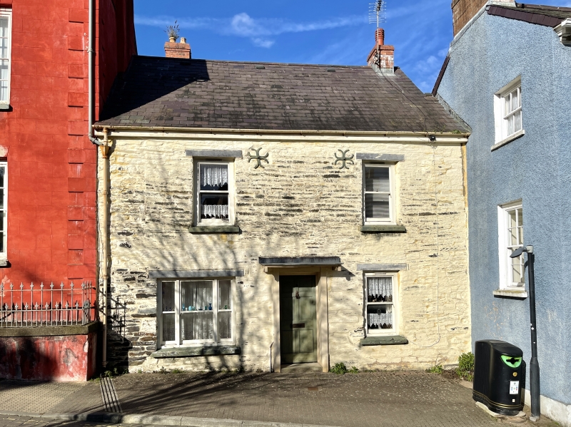
Location: Attached to No 7 and set back from street line.
County: Ceredigion
Community: Cardigan (Aberteifi)
Community: Cardigan
Built-Up Area: Cardigan
Traditional County: Cardiganshire
Tagged with: Building
C19
House, probably service wing to No 7 to which it is attached. Rubble stone with inscribed pointing as on No 7, imitation slate roof, and brick stack at east end. Two storeys, double fronted, plate glass sashes to 2 upper windows and ground floor right, tripartite sash to ground floor left. Slate sills and cemented heads. Centre 6-panel door, all panels replaced in glass, hood on timber brackets.
Included for group value.
External links are from the relevant listing authority and, where applicable, Wikidata. Wikidata IDs may be related buildings as well as this specific building. If you want to add or update a link, you will need to do so by editing the Wikidata entry.


Other nearby listed buildings
