Latitude: 52.2123 / 52°12'44"N
Longitude: -4.3357 / 4°20'8"W
OS Eastings: 240518
OS Northings: 259690
OS Grid: SN405596
Mapcode National: GBR DF.2M7L
Mapcode Global: VH3JQ.SNSF
Plus Code: 9C4Q6M67+WP
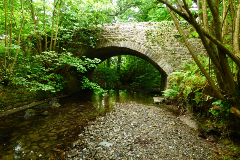
Entry Name: Pont Llanina
Listing Date: 25 February 1993
Last Amended: 25 February 1993
Grade: II
Source: Cadw
Source ID: 10682
Building Class: Transport
ID on this website: 300010682
Location: Situated just S of Llanina mansion and church, some 200m from sea.
County: Ceredigion
Community: Llanllwchaiarn (Llanllwchhaearn)
Community: Llanllwchaiarn
Locality: Llanina
Traditional County: Cardiganshire
Tagged with: Bridge Road bridge
Possibly early C19
Road bridge over stream. Rubble stone, hump-backed, single, broad segmental arch with cut stone voussoirs. Rubble stone parapet and approach walls.
Situated over concrete weir with salmon leap.
External links are from the relevant listing authority and, where applicable, Wikidata. Wikidata IDs may be related buildings as well as this specific building. If you want to add or update a link, you will need to do so by editing the Wikidata entry.


Other nearby listed buildings