Approximate Location Map
Large Map »
Latitude: 51.7157 / 51°42'56"N
Longitude: -3.4775 / 3°28'39"W
OS Eastings: 298021
OS Northings: 202920
OS Grid: SN980029
Mapcode National: GBR HJ.340M
Mapcode Global: VH5GM.N4XK
Plus Code: 9C3RPG8C+7X
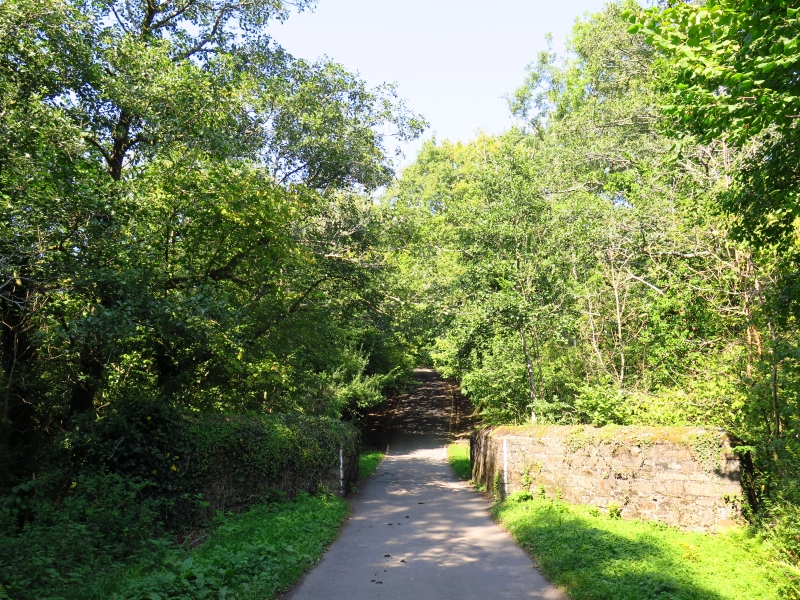
Entry Name: Bridge Over River Dare
Listing Date: 10 January 1991
Last Amended: 10 January 1991
Grade: II
Source: Cadw
Source ID: 10871
Building Class: Transport
ID on this website: 300010871
Location: Spanning the River Dare at the NW entrance to the Dare Valley Country Park. Reached down hill from Cwmdare.
County: Rhondda Cynon Taff
Community: Aberdare (Aberdâr)
Community: Aberdare West
Locality: Cwmdare
Built-Up Area: Aberdare
Traditional County: Glamorgan
Tagged with: Bridge Road bridge
Probably mid Cl9 high single arch and single track rubble bridge. This road formerly also crossed the Dare Valley Branch of the Taff Vale Railway and the Dare Branch of the Great Western Railway, to reach the Merthyrdare Colliery.
Semi-circular arch with voussoirs. Splayed out at both ends with rounded corners to the parapets; pointed coping.
External links are from the relevant listing authority and, where applicable, Wikidata. Wikidata IDs may be related buildings as well as this specific building. If you want to add or update a link, you will need to do so by editing the Wikidata entry.


Other nearby listed buildings
