Latitude: 51.8815 / 51°52'53"N
Longitude: -3.9958 / 3°59'44"W
OS Eastings: 262725
OS Northings: 222213
OS Grid: SN627222
Mapcode National: GBR DW.RMHP
Mapcode Global: VH4HX.PYFZ
Plus Code: 9C3RV2J3+JM
Entry Name: Bandstand in Penlan Park
Listing Date: 24 June 1991
Last Amended: 24 June 1991
Grade: II
Source: Cadw
Source ID: 11048
Building Class: Gardens, Parks and Urban Spaces
ID on this website: 300011048
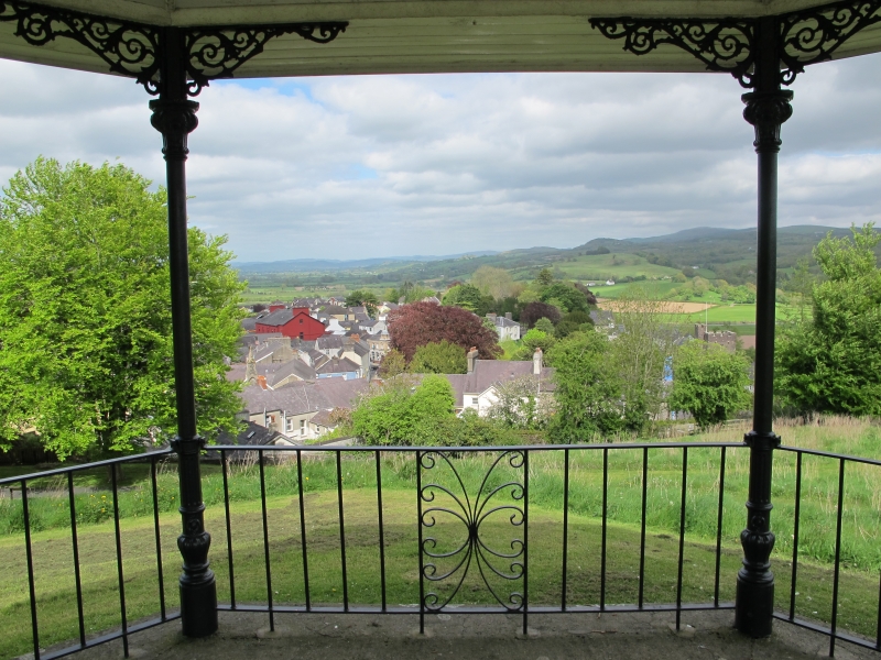
Location: Situated at the highest point of the park below Pen-lan-fawr coppice.
County: Carmarthenshire
Community: Llandeilo
Community: Llandeilo
Built-Up Area: Llandeilo
Traditional County: Carmarthenshire
Tagged with: Bandstand
Early C20 octagonal bandstand. Polygonal tiled roof with swept eaves, finial. Eight cast iron columns, scrolled brackets over foliate capitals, bulbous bases. Renewed ironwork railings. Octagonal brick stepped plinth.
External links are from the relevant listing authority and, where applicable, Wikidata. Wikidata IDs may be related buildings as well as this specific building. If you want to add or update a link, you will need to do so by editing the Wikidata entry.


Other nearby listed buildings