Approximate Location Map
Large Map »
Latitude: 51.8819 / 51°52'54"N
Longitude: -5.2653 / 5°15'55"W
OS Eastings: 175365
OS Northings: 225408
OS Grid: SM753254
Mapcode National: GBR C5.RQMZ
Mapcode Global: VH0TD.PY9R
Plus Code: 9C3PVPJM+PV
Entry Name: Milton Hall including Boundary Walls & Railings
Listing Date: 26 August 1981
Last Amended: 28 July 1992
Grade: II
Source: Cadw
Source ID: 12628
Building Class: Domestic
ID on this website: 300012628
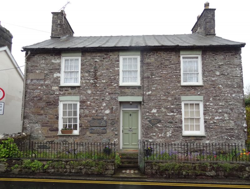
Location: Situated on SW corner of Gospel Lane, detached house in extensive garden.
County: Pembrokeshire
Community: St. David's and the Cathedral Close (Tŷddewi a Chlos y Gadeirlan)
Community: St. David's
Built-Up Area: St Davids
Traditional County: Pembrokeshire
Tagged with: Building
Mid to later C19 house built partly on site of a vaulted undercroft said to have been at corner of Gospel Lane and described in 1840 Tithe Award as 'part of Nunnery'. There is no evidence of a nunnery in Nun Street and remains have not been fully explained. In 1853 site was described as a vault and old buildings in tenure of Ezekiel Williams. House was the Congregational Manse.
Rubble stone house with grouted slate roof and stone end stacks. Two-storey three-window front of 12-pane sashes and centre door with painted brick heads. 4-panel door with narrow overlight. Slate sills. Shallow rear stair projection with 12-pane sash each side.
Wall of rubble stone extending from house to boundary with No 16 has traces of vaulting to rear. Front garden enclosed by coped dwarf rubble wall carrying slight spearhead iron rails. Matching gate.
C19 staircase etc.
External links are from the relevant listing authority and, where applicable, Wikidata. Wikidata IDs may be related buildings as well as this specific building. If you want to add or update a link, you will need to do so by editing the Wikidata entry.


Other nearby listed buildings
