Approximate Location Map
Large Map »
Latitude: 51.8706 / 51°52'14"N
Longitude: -5.2834 / 5°17'0"W
OS Eastings: 174063
OS Northings: 224207
OS Grid: SM740242
Mapcode National: GBR C5.S655
Mapcode Global: VH0TL.C7RV
Plus Code: 9C3PVPC8+6J
Entry Name: Footbridge adjacent to Road Bridge
Listing Date: 28 July 1992
Last Amended: 28 July 1992
Grade: II
Source: Cadw
Source ID: 12683
Building Class: Transport
ID on this website: 300012683
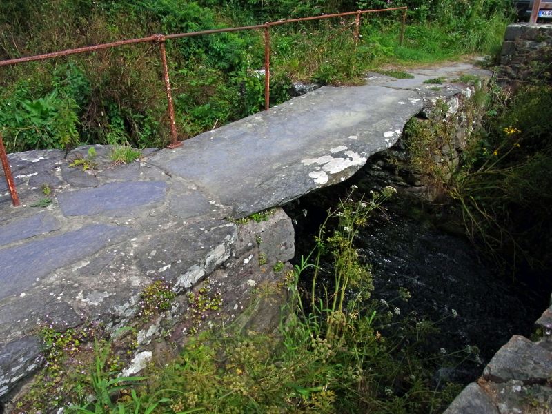
Location: Situated immediately N of roadbridge where River Alun discharges into Porthclais harbour.
County: Pembrokeshire
Community: St. David's and the Cathedral Close (Tŷddewi a Chlos y Gadeirlan)
Community: St. David's
Locality: Porthclais
Traditional County: Pembrokeshire
Tagged with: Footbridge
Uncertain date.
Clapper bridge of ancient type over River Alun with large slabs of stone laid over two rubble stone piers with upstream cutwaters. The centre spanned by an especially large slab of some 3m length. Iron handrail added in C20.
External links are from the relevant listing authority and, where applicable, Wikidata. Wikidata IDs may be related buildings as well as this specific building. If you want to add or update a link, you will need to do so by editing the Wikidata entry.


Other nearby listed buildings
