Approximate Location Map
Large Map »
Latitude: 51.794 / 51°47'38"N
Longitude: -3.9918 / 3°59'30"W
OS Eastings: 262733
OS Northings: 212465
OS Grid: SN627124
Mapcode National: GBR DW.Y2JB
Mapcode Global: VH4JH.R5KL
Plus Code: 9C3RQ2V5+H7
Entry Name: Entry Gates and Piers to Ammanford Park
Listing Date: 10 August 1994
Last Amended: 10 August 1994
Grade: II
Source: Cadw
Source ID: 14809
Building Class: Domestic
ID on this website: 300014809
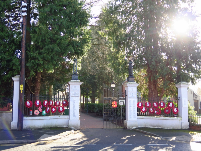
Circa 1925 War Memorial gates, substantially reconstructed c 1982.
Four tall stucco corniced piers, the inner pair with openwork iron lampstands (marked Revo, Tipton) and lamps, serpentine low connecting walls with iron railings. Pair of large iron gates, ramped up to centre, with infilled middle rail embossed 'Memorial Avenue'.
External links are from the relevant listing authority and, where applicable, Wikidata. Wikidata IDs may be related buildings as well as this specific building. If you want to add or update a link, you will need to do so by editing the Wikidata entry.


Other nearby listed buildings
