Approximate Location Map
Large Map »
Latitude: 51.5531 / 51°33'11"N
Longitude: -2.9046 / 2°54'16"W
OS Eastings: 337379
OS Northings: 184190
OS Grid: ST373841
Mapcode National: GBR J9.FB4B
Mapcode Global: VH7BM.L7T7
Plus Code: 9C3VH33W+65
Entry Name: Whitson Farm
Listing Date: 31 October 1996
Last Amended: 31 October 1996
Grade: II
Source: Cadw
Source ID: 17540
Building Class: Domestic
ID on this website: 300017540
Location: On W side of road behind Parish Reen.
County: Newport
Town: Newport
Community: Goldcliff
Community: Goldcliff
Locality: Whitson
Traditional County: Monmouthshire
Tagged with: Farmhouse
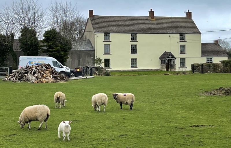
Probable origins as C17 house, rebuilt late C18/early C19, and modernised later C19.
Rendered, modern tiled roof, 3 brick chimneys to ridge. Three storeys, asymmetrical 3 window front, 9-pane sash windows to top floor, 12-pane to other floors. Open timber gabled porch over panelled door. Outshut rear. Long agricultural range to L rendered with slate roof.
Listed as well-preserved farmhouse typical of Gwent levels.
External links are from the relevant listing authority and, where applicable, Wikidata. Wikidata IDs may be related buildings as well as this specific building. If you want to add or update a link, you will need to do so by editing the Wikidata entry.


Other nearby listed buildings
