Approximate Location Map
Large Map »
Latitude: 51.5322 / 51°31'55"N
Longitude: -3.6939 / 3°41'37"W
OS Eastings: 282602
OS Northings: 182836
OS Grid: SS826828
Mapcode National: GBR H7.GPL6
Mapcode Global: VH5H8.XRK9
Plus Code: 9C3RG8J4+VC
Entry Name: Mile marker on A48, Pyle to Margam Road
Listing Date: 2 January 1998
Last Amended: 2 January 1998
Grade: II
Source: Cadw
Source ID: 19180
Building Class: Transport
ID on this website: 300019180
Location: Set at the back of the pavement, 160m S of the railway overbridge.
County: Bridgend
Town: Cynffig
Community: Pyle (Y Pîl)
Community: Pyle
Built-Up Area: Pyle
Traditional County: Glamorgan
Tagged with: Milestone
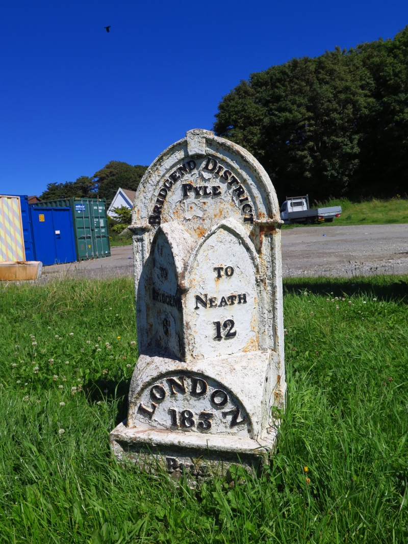
One of a group of fine mile markers, probably produced by a local Glamorganshire ironworks, and erected c.1820 for the Bridgend to Neath turnpike.
Iron casting in the form of a Gothic arch with keystone, two arches below canted to face oncoming traffic and mounted on an arched plinth, all set on a rectangular base. The top arch is inscribed BRIDGEND DISTRICT / PYLE. On the canted arches, TO / BRIDGEND / 6 ; and TO / NEATH / 12, and on the base PYLE PARISH.
Included as one of the very fine group of mile markers set along this former turnpike road.
External links are from the relevant listing authority and, where applicable, Wikidata. Wikidata IDs may be related buildings as well as this specific building. If you want to add or update a link, you will need to do so by editing the Wikidata entry.


Other nearby listed buildings
