Approximate Location Map
Large Map »
Latitude: 53.0688 / 53°4'7"N
Longitude: -3.5341 / 3°32'2"W
OS Eastings: 297307
OS Northings: 353501
OS Grid: SH973535
Mapcode National: GBR 6H.BL0L
Mapcode Global: WH66F.P495
Plus Code: 9C5R3F98+G9
Entry Name: Pont-y-rhuddfa
Listing Date: 17 February 1998
Last Amended: 17 February 1998
Grade: II
Source: Cadw
Source ID: 19352
Building Class: Transport
ID on this website: 300019352
Location: The bridge lies below the Brenig dam, on the lane running N of Pentre-llyn-cymmer.
County: Conwy
Town: Cerrigydrudion
Community: Cerrigydrudion
Community: Cerrigydrudion
Locality: Pentre-llyn-cymmer
Traditional County: Denbighshire
Tagged with: Road bridge
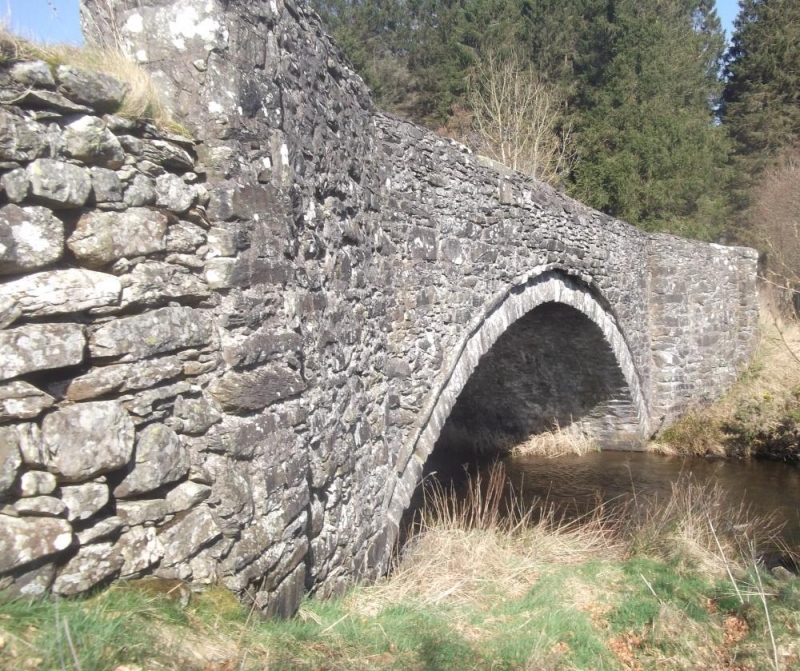
The bridge, built in 1782 by Edward Stephen and William Stephen of Llanfihangel, originally carried the road through the valley to the N and across the Afon Brenig before the construction of the Brenig dam and lake. It now lies below the dam, providing access to a caravan site.
Built of local stone rubble. A single segmental arch of slightly inset voussoirs, approximately 55cm deep, with a regulating course, the spandrels rising uninterrupted to the flush stone-coped parapet. The splayed abutments have walls outset from the parallel sided bridge, the copings extending to square end piers. The parapet follows the road line, sloping downwards to the N. Some copings on the E side are replaced in concrete.
Included as a fine country bridge, one of a range of such road improvments carried out in this part of Wales in the late C18 and early C19, and where the actual date and persons responsible are recorded.
External links are from the relevant listing authority and, where applicable, Wikidata. Wikidata IDs may be related buildings as well as this specific building. If you want to add or update a link, you will need to do so by editing the Wikidata entry.


Other nearby listed buildings
