Approximate Location Map
Large Map »
Latitude: 51.7344 / 51°44'3"N
Longitude: -5.2451 / 5°14'42"W
OS Eastings: 176022
OS Northings: 208947
OS Grid: SM760089
Mapcode National: GBR G1.HY35
Mapcode Global: VH0V6.1NGS
Plus Code: 9C3PPQM3+PX
Entry Name: Deer Park Wall
Listing Date: 23 February 1998
Last Amended: 23 February 1998
Grade: II
Source: Cadw
Source ID: 19404
Building Class: Gardens, Parks and Urban Spaces
ID on this website: 300019404
Location: Running S from Martin's Haven to the sea at Renny Slip, enclosing the former Deer Park to the W.
County: Pembrokeshire
Town: Haverfordwest
Community: Marloes and St. Brides (Marloes a Sain Ffrêd)
Community: Marloes and St. Brides
Locality: Martin's Haven
Traditional County: Pembrokeshire
Tagged with: Wall
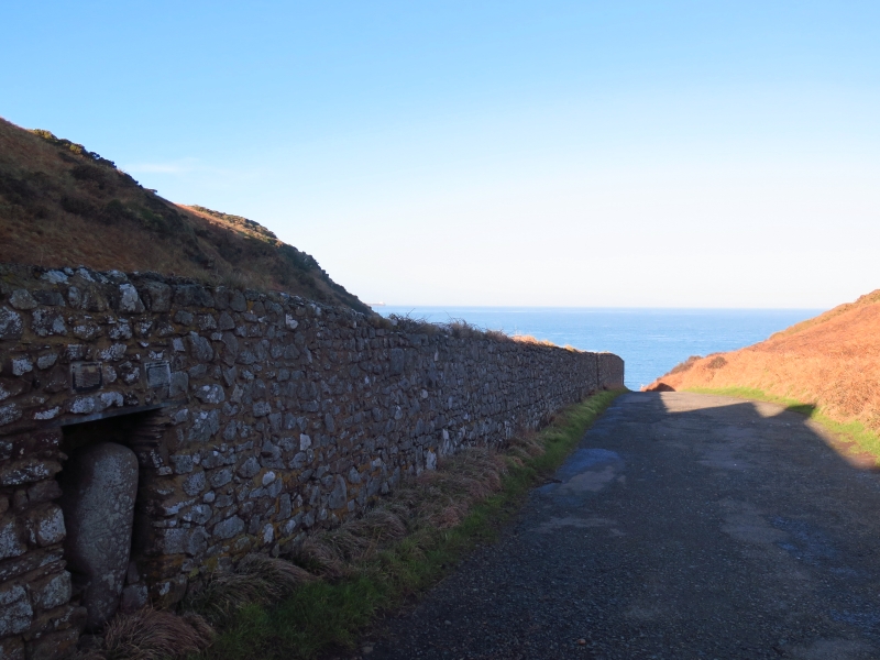
Enclosing wall of a deer park of uncertain date possibly C18 or early C19. A Deer Park of 57 acres (23 hectares) is marked on the Tithe Map of 1845 owned by William Philipps of St Brides Casle. The wall separates the headland at Martin's Haven from the mainland.
Long rubble stone deer-park wall with rough stone coping running for some 450m metres between Martin's Haven on the N and Renney's Slip on the S. Wall is some two to three metres high. Cottages (now converted to conveniences and exhibition area) built behind at Martin's Haven and niche made adjoining to display cross-inscribed stone found nearby in the 1980s.
Included as a landscape feature of historical significance in a magnificent coastal area.
External links are from the relevant listing authority and, where applicable, Wikidata. Wikidata IDs may be related buildings as well as this specific building. If you want to add or update a link, you will need to do so by editing the Wikidata entry.


Other nearby listed buildings
