Latitude: 51.7141 / 51°42'50"N
Longitude: -5.1435 / 5°8'36"W
OS Eastings: 182937
OS Northings: 206381
OS Grid: SM829063
Mapcode National: GBR G3.Z165
Mapcode Global: VH1RW.S5PV
Plus Code: 9C3PPV74+JH
Entry Name: Folly SE of Monk Haven
Listing Date: 25 August 1998
Last Amended: 25 August 1998
Grade: II
Source: Cadw
Source ID: 20345
Building Class: Domestic
ID on this website: 300020345
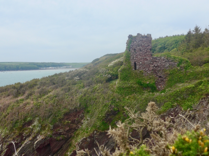
Location: Situated on the coast path some 250m SE of Monk Haven and just E of Loose Haven, SW of the village of St Ishmaels.
County: Pembrokeshire
Town: Haverfordwest
Community: St. Ishmael's (Llanisan-yn-Rhos)
Community: St. Ishmael's
Locality: Monk Haven
Traditional County: Pembrokeshire
Tagged with: Folly
Small tower, possibly mid C19, partially collapsed. Built probably for the owners of the Trewarren estate as a look-out, but purpose and history obscure. Trewarren house was built in 1845.
Small tower, red sandstone rubble, originally square plan with battlemented top, but SE corner collapsed. N side pointed door with brick head at ground level, large flight of rubble stone outside steps to left to first floor opening, missing lintel. Small W lancet and blocked lancet E, at ground floor. S side collapsed.
Included as a picturesque castellated folly in a prominent clifftop location.
External links are from the relevant listing authority and, where applicable, Wikidata. Wikidata IDs may be related buildings as well as this specific building. If you want to add or update a link, you will need to do so by editing the Wikidata entry.


Other nearby listed buildings