Approximate Location Map
Large Map »
Latitude: 51.5865 / 51°35'11"N
Longitude: -3.6504 / 3°39'1"W
OS Eastings: 285756
OS Northings: 188802
OS Grid: SS857888
Mapcode National: GBR H9.C8HS
Mapcode Global: VH5H3.PD15
Plus Code: 9C3RH8PX+HV
Entry Name: Churchyard walls around the graveyard, Church of St Cynwyd
Listing Date: 8 September 1998
Last Amended: 8 September 1998
Grade: II
Source: Cadw
Source ID: 20437
Building Class: Religious, Ritual and Funerary
ID on this website: 300020437
Location: The main churchyard surrounds the church, in the centre of the village.
County: Bridgend
Town: Llangynwyd Middle
Community: Llangynwyd Middle (Llangynwyd - Canol)
Community: Llangynwyd Middle
Locality: Llangynwyd
Traditional County: Glamorgan
Tagged with: Churchyard wall
The church at Llangynwyd is probably of pre-Norman origin, and a building is recorded in 1173.
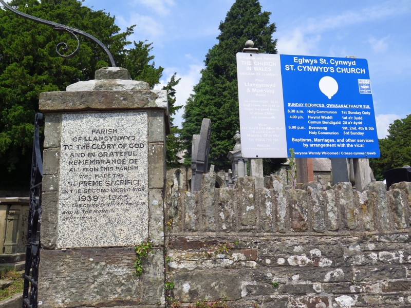
The churchyard is D-shaped, closely surrounded by the road, and is walled all round, the S quadrant consisting of up to 2.3m high high retaining walls of Pennant sandstone, probably of early origin and now largely C18-C19, with a gate on the S, and a further gate on the W side leading to the large graveyard extension. The S gate piers are of ashlar, with stepped cappings and an iron overthrow with a central lantern. The W pier has an inserted granite panel, a memorial to the 1914-1918 war, inscribed in Welsh, the E pier has a similar panel in English for the 1939-1945 war. The E piers are large, of rock-faced rubble and domed tops, also with iron gates.
Included as an important feature in the village centre, of group value with the church of St Cynwyd and other listed items in the conservation area.
External links are from the relevant listing authority and, where applicable, Wikidata. Wikidata IDs may be related buildings as well as this specific building. If you want to add or update a link, you will need to do so by editing the Wikidata entry.


Other nearby listed buildings
