Approximate Location Map
Large Map »
Latitude: 51.6322 / 51°37'55"N
Longitude: -4.0804 / 4°4'49"W
OS Eastings: 256110
OS Northings: 194650
OS Grid: SS561946
Mapcode National: GBR GV.D5RS
Mapcode Global: VH4K7.776L
Plus Code: 9C3QJWJ9+VR
Entry Name: Caer Eithin Engine House, Berthlwyd Colliery
Listing Date: 5 June 2000
Last Amended: 5 June 2000
Grade: II
Source: Cadw
Source ID: 23484
Building Class: Industrial
ID on this website: 300023484
Location: 500m west of Poundffald Farm, on the hilltop to the north side of the lane to Blue Anchor.
County: Swansea
Town: Swansea
Community: Three Crosses (Y Crwys)
Community: Llanrhidian Higher
Locality: Three Crosses
Built-Up Area: Gowerton
Traditional County: Glamorgan
Tagged with: Architectural structure
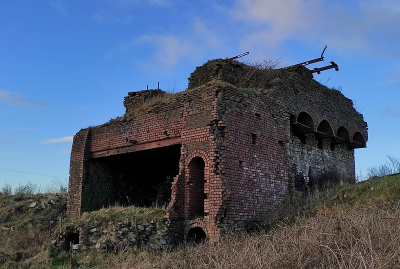
Caer Eithin was one of a group of early C20 coal works, operated in conjunction with Wernbwll, Penlan and Berthlwyd. The coal outcrops at the hilltop at Caer Eithin and dips at about 30 degrees northward. The engine house at Caer Eithin raises questions about its precise function, but it is believed it drew coals up from the Penlan and Main seams to be transferred underground to a tramway which ran in a tunnel to Berthlwyd, about 1.5km to the north. The Caer Eithin engine house was perhaps contemporary with the tunnel, which is known to have existed by 1909. The earliest reference to the engine house is in 1914. There were additional adjacent buildings to the south and the east sides, now demolished, but of which traces are visible on the faces of the surviving structure. The engine house is believed to have fallen into ruin shortly after the cessation of the works in 1937.
It is believed that the structure supported electrical machinery at its top level but what alteration this entailed in construction or in manner of working is not yet ascertained. The great height and massiveness of the structure suggests an intention to change to transporting coal by means of an above-ground rope conveyor, but this is hypothetical.
A complex structure of local sandstone rubble with features in red brick. Its main part is a mass about 10m by 8m and about 5m high, through which a large brick-vaulted tunnel passes north-south, widening out on the north face. From within the large tunnel a small sloping tunnel extends downwards to the east. Two substantial additional wings of brick and stone extend to the south, between which there is an area of raised ground containing two small parallel blind tunnels in brickwork. There were additional buildings to south and east, now lost, and a top storey.
The historical evidence indicates that at ground level there was a steam engine. It is probable that its steam raising equipment was located at the south side, perhaps on the raised platform. A small amount of coal would probably be drawn up from the mine to provide fuel for the boilers. On the south face of the surviving structure there are indications of an abutting roof, taken to be that of a boiler house. No chimney position is apparent.
The top storey has been reinforced with steelwork to create a larger platform by cantilevering five rolled steel joists outwards on the east and west sides and forming a set of tied brick arches between them. The engine installed at the top is thought to have been electrically powered. Local oral evidence suggests there was a ladder on the west face giving access to this upper engine house.
Another platform of steel joists with brick arches, at about 1m lower level, forms a roof between the south-pointing wing walls. On the east face of the eastern wing wall is the mark of another roof, indicating there was an abutting building on this side; a narrow opening gave pedestrian access between the suriving structure and this lost building.
A complex colliery engine structure, and an important relic of the Gower coalmining industry.
External links are from the relevant listing authority and, where applicable, Wikidata. Wikidata IDs may be related buildings as well as this specific building. If you want to add or update a link, you will need to do so by editing the Wikidata entry.


Other nearby listed buildings
