Latitude: 51.9487 / 51°56'55"N
Longitude: -3.3919 / 3°23'30"W
OS Eastings: 304433
OS Northings: 228717
OS Grid: SO044287
Mapcode National: GBR YP.MF8V
Mapcode Global: VH6BZ.586Y
Plus Code: 9C3RWJX5+F6
Entry Name: Castle Street
Listing Date: 16 December 1976
Last Amended: 4 November 2005
Grade: II
Source: Cadw
Source ID: 85590
ID on this website: 300085590
Location: About 50m from junction with High Street.
County: Powys
Town: Brecon
Community: Brecon (Aberhonddu)
Community: Brecon
Built-Up Area: Brecon
Traditional County: Brecknockshire
Tagged with: Architectural structure
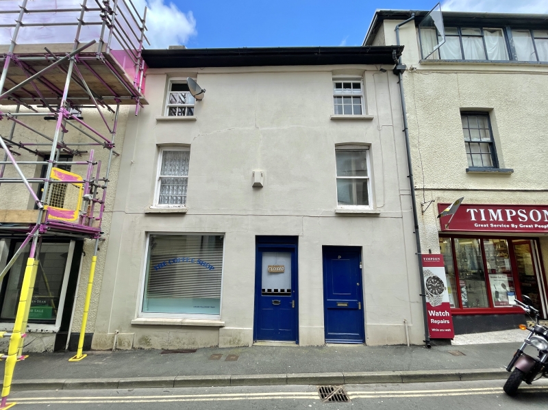
Early-to-mid C19.
Shop with accommodation above. Three-storey, 2-window front, cement rendered with band at eaves, pilasters and plinth. On second floor, 2 hopper windows imitating 9-pane sashes; on first floor, 2 sash windows without glazing bars. On ground floor, central doorway to shop (modern shop window to L); second doorway towards R.
Included for Group Value with other Listed Buildings in Castle Street.
External links are from the relevant listing authority and, where applicable, Wikidata. Wikidata IDs may be related buildings as well as this specific building. If you want to add or update a link, you will need to do so by editing the Wikidata entry.


Other nearby listed buildings