-
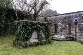
Unidentified Monument in the Churchyard, 15 Metres South of South Chapel, Church of St Mary
Unidentified monument in churchyard of St Mary's, Wedmore, Somerset
-
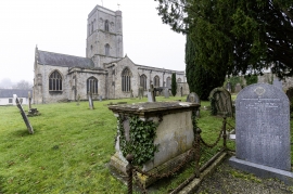
Unidentified Monument in the Churchyard, 18 Metres South of South Chapel, Church of St Mary
Unidentified monument in churchyard of St Mary's, Wedmore, Somerset
-
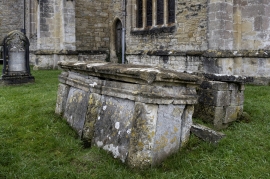
Monument to Savidge Family, in Churchyard Approximately 40 Metres North of the Chancel, Church of St
Savidge family monument in churchyard of St Mary's, Wedmore, Somerset
-
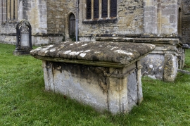
Monument to Savidge Family, in Churchyard Approximately 40 Metres North of the Chancel, Church of St
Savidge family monument in churchyard of St Mary's, Wedmore, Somerset
-
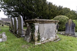
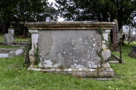
Monument to Savidge Family, in Churchyard Approximately 40 Metres North of the Chancel, Church of St
Savidge family monument in churchyard of St Mary's, Wedmore, Somerset
-
Unidentified Monument in the Churchyard, 8 Metres North of North Aisle, Church of St Mary
Unidentified monument in churchyard of St Mary's, Wedmore, Somerset
-
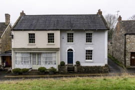
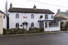
Post Office
The Old Post Office, Church Street, Wedmore, Somerset
-
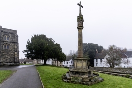
Wedmore War Memorial
Wedmore War Memorial, Somerset
-
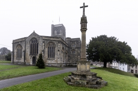
Wedmore War Memorial
Wedmore War Memorial, Somerset
-
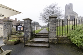
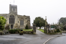
Railings, Piers and Gates at South East Entrance to the Churchyard, Church of St Mary
SE entrance to churchyard of St Mary's, Wedmore, Somerset
-
Railings, Piers, Gates and Lamp Overthrow at South West Entrance to Churchyard, Church of St Mary
SW entrance to churchyard of St Mary's, Wedmore, Somerset
-
Railings, Piers, Gates and Lamp Overthrow at South West Entrance to Churchyard, Church of St Mary
SW entrance to churchyard of St Mary's, Wedmore, Somerset
-
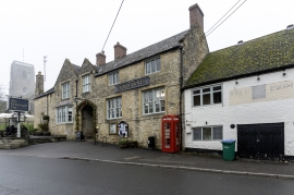
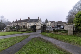
The George Hotel
The George Hotel, Church Street, Wedmore, Somerset
-
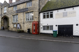
K6 Telephone Kiosk Outside the George Hotel, Church Street
K6 Telephone Kiosk, Church Street, Wedmore, Somerset
-
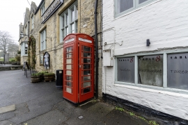
K6 Telephone Kiosk Outside the George Hotel, Church Street
K6 Telephone Kiosk, Church Street, Wedmore, Somerset
-
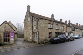
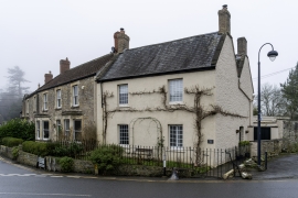
House Opposite George Hotel, Including Mounting Block
House in Church Street, Wedmore, Somerset
-
The Borough Venture and Forecourt Wall
Bluebird Cafe in The Borough, Wedmore, Somerset
-
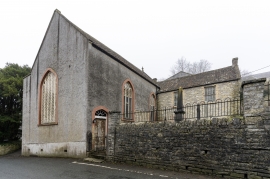
Wedmore Baptist Church
Wedmore Baptist Church, Grant's Lane, Wedmore, Somerset
-
Boundary Wall, Gates, Gate Piers and Railings to the Grounds of Manor Cottage, Middle Manor and Sout
Wall to Manor Cottage, Middle and South Manor, Wedmore, Somerset
-
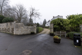
Boundary Wall, Gates, Gate Piers and Railings to the Grounds of Manor Cottage, Middle Manor and Sout
Wall and gates to Manor Cottage, Middle and South Manor, Wedmore, Somerset
-
Church Villa and Forecourt Railings
Church Villa, Wedmore, Somerset
-
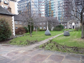
Hoptons Almshouses Hopton Gardens
Hopton's Charity Almshouses
-
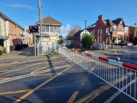
Birkdale Signal Box
Birkdale signal box
-
Church of St Giles
Church of St Giles, Kilmington, Devon
-
Church of St Giles
Church of St Giles, Kilmington, Devon
-
Church of St Giles
Church of St Giles, Kilmington, Devon
-
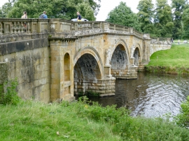
Bridge on Main Approach to Chatsworth House
An oblique general view of the south elevation.
-
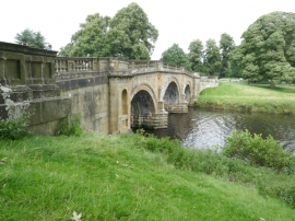
Bridge on Main Approach to Chatsworth House
A general view of the south elevation.
-
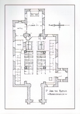
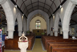
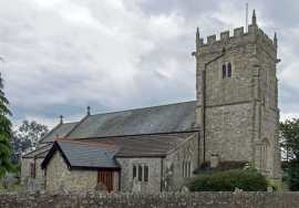
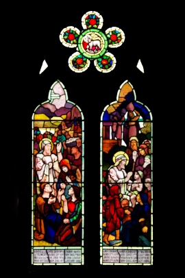
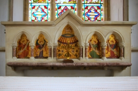
Church of St John the Baptist
Church of St John the Baptist, Hawkchurch, Devon
-
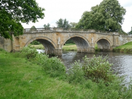
Bridge on Main Approach to Chatsworth House
A view of the south elevation.
-
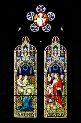
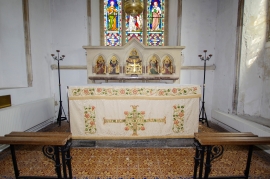
Church of St John the Baptist
Church of St John the Baptist, Hawkchurch, Devon
-
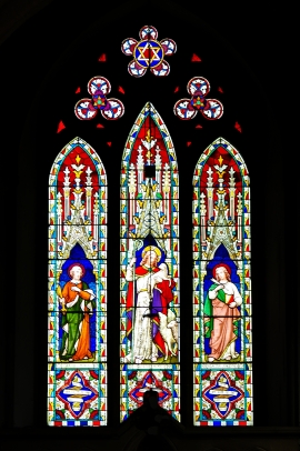
Church of St John the Baptist
Church of St John the Baptist, Hawkchurch, Devon
-
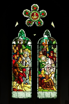
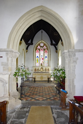
Church of St John the Baptist
Church of St John the Baptist, Hawkchurch, Devon
-
Church of St John the Baptist
Church of St John the Baptist, Hawkchurch, Devon
-
Church of St John the Baptist
Church of St John the Baptist, Hawkchurch, Devon
-
Church of St John the Baptist
Church of St John the Baptist, Hawkchurch, Devon
-
Church of St John the Baptist
Church of St John the Baptist, Hawkchurch, Devon
-
Church of St John the Baptist
Church of St John the Baptist, Hawkchurch, Devon
-
Church of St John the Baptist
Church of St John the Baptist, Hawkchurch, Devon
-
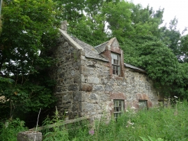
East Cottage, Kirktown Cottages, Inverkeithny
East Cottage, Kirktown Cottages, Inverkeithny