Approximate Location Map
Large Map »
Latitude: 51.2403 / 51°14'25"N
Longitude: -2.204 / 2°12'14"W
OS Eastings: 385852
OS Northings: 149031
OS Grid: ST858490
Mapcode National: GBR 1TS.1LJ
Mapcode Global: VH97G.R351
Plus Code: 9C3V6QRW+49
Entry Name: Unidentified Monument in the Churchyard About 3 Metres South of Church of St Mary
Listing Date: 5 November 1987
Grade: II
Source: Historic England
Source ID: 1021477
English Heritage Legacy ID: 313757
ID on this website: 101021477
Location: St Mary's Church, Old Dilton, Wiltshire, BA13
County: Wiltshire
Civil Parish: Dilton Marsh
Built-Up Area: Westbury
Traditional County: Wiltshire
Lieutenancy Area (Ceremonial County): Wiltshire
Church of England Parish: Westbury
Church of England Diocese: Salisbury
Tagged with: Monument
DILTON MARSH OLD DILTON
ST 84 NE
(west side)
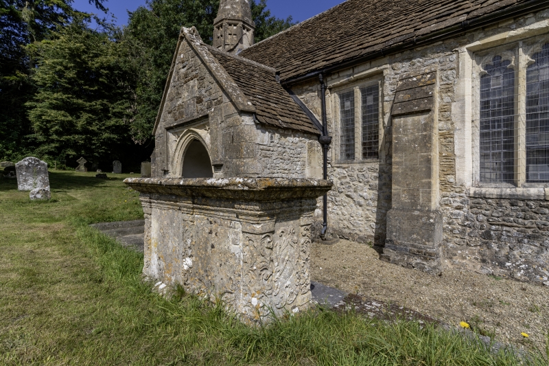
8/119 Unidentified monument in the church-
yard about 3 metres south of Church
of St Mary
GV II
Chest tomb. Probably late C17. Limestone. Plinth, two shield-
shaped panels to main sides with relief-carved scroll decoration to
centre and corner pilasters, west end panel has three cherubs, east
panel has heraldic cartouche, cornice to cyma-moulded flat top.
Illegible inscriptions.
Listing NGR: ST8585249031
External links are from the relevant listing authority and, where applicable, Wikidata. Wikidata IDs may be related buildings as well as this specific building. If you want to add or update a link, you will need to do so by editing the Wikidata entry.


Other nearby listed buildings
