Latitude: 51.3219 / 51°19'18"N
Longitude: -2.2068 / 2°12'24"W
OS Eastings: 385685
OS Northings: 158106
OS Grid: ST856581
Mapcode National: GBR 1ST.0WS
Mapcode Global: VH972.P1QG
Plus Code: 9C3V8QCV+Q7
Entry Name: Nos 16 and 17 Incorporating the Former National Schools
Listing Date: 26 November 1976
Grade: II
Source: Historic England
Source ID: 1021540
English Heritage Legacy ID: 313911
ID on this website: 101021540
Location: Trowbridge, Wiltshire, BA14
County: Wiltshire
Civil Parish: Trowbridge
Built-Up Area: Trowbridge
Traditional County: Wiltshire
Lieutenancy Area (Ceremonial County): Wiltshire
Church of England Parish: Trowbridge St James
Church of England Diocese: Salisbury
Tagged with: Building
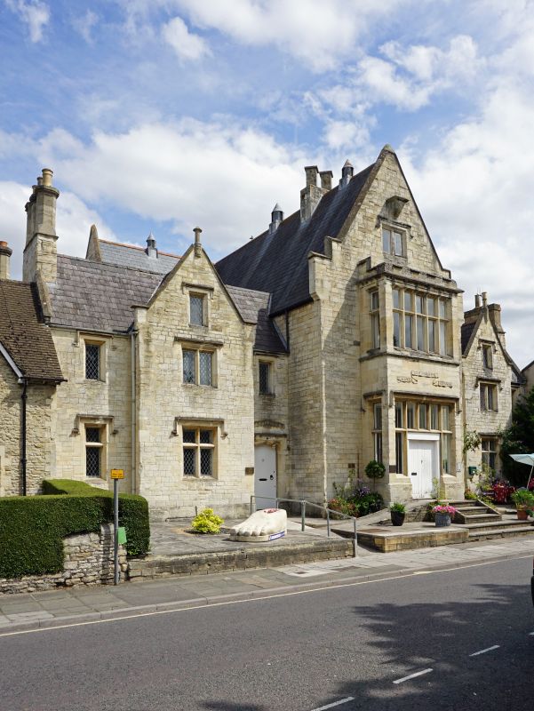
CHURCH STREET 1. 5411 (North Side) Nos 16 and 17 incorporating the former National Schools. ST 8558 5/178 II GV
2. Dated 1842. Manners (of Bath) architect. Symmetrical (although the left hand block may have been an after thought). Elizabethan design with projecting central gable and 2 projecting subsiduary gables. Dressed stone front. 2 1/2 storeys. The central gable has a 2 storey square 7 light mullion and transom bay with Tudor rose cornice and blocking course, and having a scroll inscribed "National A.D. MDCCCXLII Schools" between 1st and 2nd floors. Each gable has 2 steps at each side, lower step a kneeler. 2 light attic window to main gable with drip mould and worn corbel above formerly supporting statue. Flanking wings have central gabled breaks with apex finials and 2 light mullion windows; single light windows in attic, mullion and transom windows to ground floor. Flanking single light windows. All windows have drip moulds. Doorways flank main central break. Tudor arches over, also with drip moulds. To left scrolled inscription "Boys' School" and to right "...Girls' School", both in Gothic lettering. Slate roofs with gable ends chimneys, 3 octagonal stacks on left hand. Long cross-ridged extension at rear. The former open balustraded street-wall with arcaded balustrade and weathered coping only remains in front of No 16, and 2 piers of gate piers with weathered set off capping.
Nos 16 to 19 (consec), incorporating the former National Schools form a group with Nos 1 to 4 (consec) Union Street Almshouses, Street Wall fronting Almshouses, No 9 and St James's Hall, Union Street.
Listing NGR: ST8567858112
External links are from the relevant listing authority and, where applicable, Wikidata. Wikidata IDs may be related buildings as well as this specific building. If you want to add or update a link, you will need to do so by editing the Wikidata entry.


Other nearby listed buildings