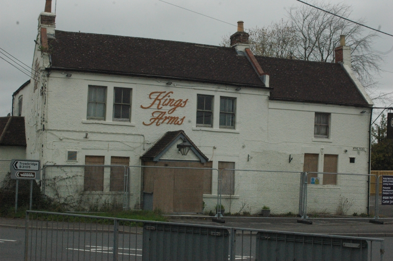
Latitude: 51.3406 / 51°20'26"N
Longitude: -2.2002 / 2°12'0"W
OS Eastings: 386149
OS Northings: 160191
OS Grid: ST861601
Mapcode National: GBR 1SF.VZ9
Mapcode Global: VH96W.TK6M
Plus Code: 9C3V8QRX+7W
Entry Name: The Kings Arms Public House
Listing Date: 26 November 1976
Grade: II
Source: Historic England
Source ID: 1021678
English Heritage Legacy ID: 314198
ID on this website: 101021678
Location: Hilperton Marsh, Wiltshire, BA14
County: Wiltshire
Civil Parish: Hilperton
Built-Up Area: Trowbridge
Traditional County: Wiltshire
Lieutenancy Area (Ceremonial County): Wiltshire
Church of England Parish: Staverton with Hilperton Marsh
Church of England Diocese: Salisbury
Tagged with: Pub
WYKE ROAD 1. 5411 (West Side) The King's Arms Public House ST 86 SE 1/406
II GV
2. Late C18. 2 storeys painted pebbledash. 2+1 windows, late glazed sashes. Main part has coupled windows with beaded inner edges, another similar on ground floor to right. Modern thin band over ground floor. Doorway in centre of main part, rusticated quoins and brackets to hood, 6 panel door. Modern porch to right. Main part has tiled roof with coped verges and gable end chimneys; addition has pantiles also with coped verge and gable end chimney. Rubble extensions to rear.
The King's Arms Public House forms a group with Nos 1 and 3 and Nos 2 and 4 Marsh Road.
Listing NGR: ST8614960191
External links are from the relevant listing authority and, where applicable, Wikidata. Wikidata IDs may be related buildings as well as this specific building. If you want to add or update a link, you will need to do so by editing the Wikidata entry.


Other nearby listed buildings