Latitude: 51.6406 / 51°38'26"N
Longitude: -1.852 / 1°51'7"W
OS Eastings: 410337
OS Northings: 193543
OS Grid: SU103935
Mapcode National: GBR 3S2.0M5
Mapcode Global: VHB35.V184
Plus Code: 9C3WJ4RX+65
Entry Name: 19, Calcutt Street
Listing Date: 17 April 1986
Grade: II
Source: Historic England
Source ID: 1023090
English Heritage Legacy ID: 317751
ID on this website: 101023090
Location: Cricklade, Wiltshire, SN6
County: Wiltshire
Civil Parish: Cricklade
Built-Up Area: Cricklade
Traditional County: Wiltshire
Lieutenancy Area (Ceremonial County): Wiltshire
Church of England Parish: Cricklade
Church of England Diocese: Bristol
Tagged with: Building
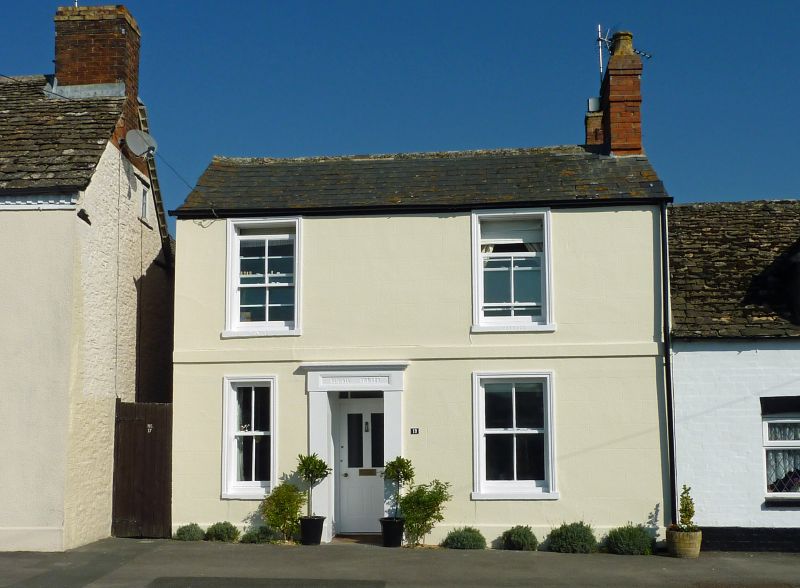
SU 19 SW CRICKLADE CALCUTT STREET
(north side)
13/102
No. 19
GV
II
House, mid C19. Limestone, rendered and lined as ashlar. Welsh
slate roof. Two storeys, 2 bays. Off-centre door in raised
rendered doorcase. Raised plinth and plat band. Four-pane sashes
with moulded architraves, the window to left of door narrower.
Stack to right gable. Included for group value.
Listing NGR: SU1033793543
External links are from the relevant listing authority and, where applicable, Wikidata. Wikidata IDs may be related buildings as well as this specific building. If you want to add or update a link, you will need to do so by editing the Wikidata entry.


Other nearby listed buildings