Approximate Location Map
Large Map »
Latitude: 51.6406 / 51°38'26"N
Longitude: -1.8521 / 1°51'7"W
OS Eastings: 410331
OS Northings: 193544
OS Grid: SU103935
Mapcode National: GBR 3S2.0L2
Mapcode Global: VHB35.V174
Plus Code: 9C3WJ4RX+65
Entry Name: 18, Calcutt Street
Listing Date: 26 August 1976
Grade: II
Source: Historic England
Source ID: 1284315
English Heritage Legacy ID: 317750
ID on this website: 101284315
Location: Cricklade, Wiltshire, SN6
County: Wiltshire
Civil Parish: Cricklade
Built-Up Area: Cricklade
Traditional County: Wiltshire
Lieutenancy Area (Ceremonial County): Wiltshire
Church of England Parish: Cricklade
Church of England Diocese: Bristol
Tagged with: Building
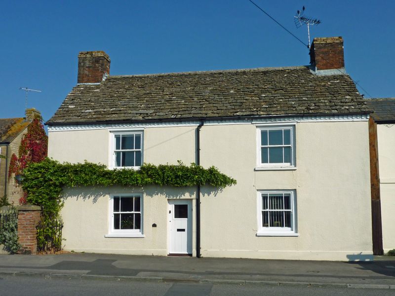
SU 19 SW CRICKLADE CALCUTT STREET
(north side)
13/101 No. 18
26.8.76
GV II
House. C18. Painted roughcast limestone rubble, stone slate roof.
Two storeys, 2 bays. Left ground floor shop window of 3-lights.
Margin-glazed sashes widely spaced. Stacks to gables. Lean-to
extension to rear. Brick dentilled eaves. Included for group value.
Listing NGR: SU1033193544
External links are from the relevant listing authority and, where applicable, Wikidata. Wikidata IDs may be related buildings as well as this specific building. If you want to add or update a link, you will need to do so by editing the Wikidata entry.


Other nearby listed buildings
