Latitude: 51.6414 / 51°38'29"N
Longitude: -1.8564 / 1°51'23"W
OS Eastings: 410032
OS Northings: 193635
OS Grid: SU100936
Mapcode National: GBR 3S1.5GH
Mapcode Global: VHB35.R0YH
Plus Code: 9C3WJ4RV+HC
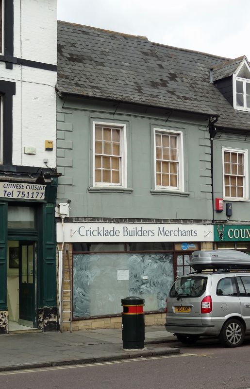
Entry Name: 35, High Street
Listing Date: 17 January 1955
Grade: II
Source: Historic England
Source ID: 1023101
English Heritage Legacy ID: 317779
ID on this website: 101023101
Location: Cricklade, Wiltshire, SN6
County: Wiltshire
Civil Parish: Cricklade
Built-Up Area: Cricklade
Traditional County: Wiltshire
Lieutenancy Area (Ceremonial County): Wiltshire
Church of England Parish: Cricklade
Church of England Diocese: Bristol
Tagged with: Building
SU 19 SW CRICKLADE HIGH STREET
(west side)
13/129 No. 35
17.1.55
GV II
Shop. C18. Rendered and lined as ashlar. Welsh slate roof. Two
storeys, 2 bays C20 ground floor shopfront. Twelve-pane sashes,
boxes concealed, within raised moulded architraves. Raised quoins.
Bullnosed sills. Coved and moulded eaves. Long timber framed
range to rear with jetty to first floor.
Listing NGR: SU1002993643
External links are from the relevant listing authority and, where applicable, Wikidata. Wikidata IDs may be related buildings as well as this specific building. If you want to add or update a link, you will need to do so by editing the Wikidata entry.


Other nearby listed buildings