Latitude: 51.6416 / 51°38'29"N
Longitude: -1.8563 / 1°51'22"W
OS Eastings: 410040
OS Northings: 193658
OS Grid: SU100936
Mapcode National: GBR 3S1.5HJ
Mapcode Global: VHB2Z.SZ0X
Plus Code: 9C3WJ4RV+MF
Entry Name: 38, High Street
Listing Date: 17 January 1955
Grade: II
Source: Historic England
Source ID: 1356062
English Heritage Legacy ID: 317782
ID on this website: 101356062
Location: Cricklade, Wiltshire, SN6
County: Wiltshire
Civil Parish: Cricklade
Built-Up Area: Cricklade
Traditional County: Wiltshire
Lieutenancy Area (Ceremonial County): Wiltshire
Church of England Parish: Cricklade
Church of England Diocese: Bristol
Tagged with: Building
SU 19 SW CRICKLADE HIGH STREET (west side)
13/132 No. 38 17.1.55 GV II
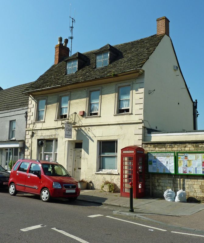
House. C17, altered in early C19. Painted rendered stone. Stone slate roof. Two storeys and attic. Four bays. Raised quoins and plat band. Recessed central 6-panel door and leaded fanlight, the reveals also panelled. Fluted tripartite window to left, and margin glazed sash to right on ground floor. First floor has plate glass sashes with moulded architraves and sills. Wide moulded eaves. Two hipped dormers and gable brick stacks. Rear gable timber framed. Three bay lower rear wing with stone slate roof and sliding timber casement windows.
Listing NGR: SU1000893670
External links are from the relevant listing authority and, where applicable, Wikidata. Wikidata IDs may be related buildings as well as this specific building. If you want to add or update a link, you will need to do so by editing the Wikidata entry.


Other nearby listed buildings