Latitude: 51.6594 / 51°39'33"N
Longitude: -1.8717 / 1°52'18"W
OS Eastings: 408970
OS Northings: 195627
OS Grid: SU089956
Mapcode National: GBR 3RN.TWX
Mapcode Global: VHB2Z.HKV9
Plus Code: 9C3WM45H+P8
Entry Name: Street Farmhouse
Listing Date: 17 April 1986
Grade: II
Source: Historic England
Source ID: 1023136
English Heritage Legacy ID: 317863
ID on this website: 101023136
Location: Latton, Wiltshire, SN6
County: Wiltshire
Civil Parish: Latton
Traditional County: Wiltshire
Lieutenancy Area (Ceremonial County): Wiltshire
Church of England Parish: Latton
Church of England Diocese: Bristol
Tagged with: Farmhouse
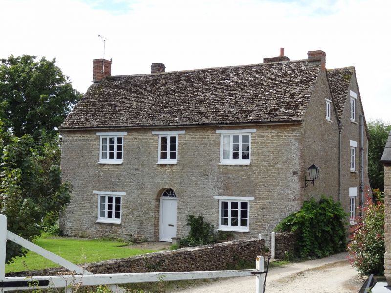
SU 09 NE LATTON ERMIN STREET
(south-west side)
2/213 Street Farmhouse
II
Farmhouse, c.1800. Limestone rubble with tiled roof. Two-storeys,
3 bays, with parallel range to rear. Central 6-panelled door and
radial fanlight. Three-light casement windows with timber lintels.
Gable stacks to both front and rear blocks. Open verandah to rear.
Listing NGR: SU0897095627
External links are from the relevant listing authority and, where applicable, Wikidata. Wikidata IDs may be related buildings as well as this specific building. If you want to add or update a link, you will need to do so by editing the Wikidata entry.


Other nearby listed buildings