Latitude: 51.6136 / 51°36'48"N
Longitude: -1.8712 / 1°52'16"W
OS Eastings: 409017
OS Northings: 190532
OS Grid: SU090905
Mapcode National: GBR 3S7.V1C
Mapcode Global: VHB35.JP4X
Plus Code: 9C3WJ47H+CG
Entry Name: Dairy Farmhouse
Listing Date: 17 April 1986
Grade: II
Source: Historic England
Source ID: 1023184
English Heritage Legacy ID: 317980
ID on this website: 101023184
Location: Purton Stoke, Wiltshire, SN5
County: Wiltshire
Civil Parish: Purton
Traditional County: Wiltshire
Lieutenancy Area (Ceremonial County): Wiltshire
Church of England Parish: Purton
Church of England Diocese: Bristol
Tagged with: Farmhouse
SU 09 SE PURTON PURTON STOKE
(north side)
5/334
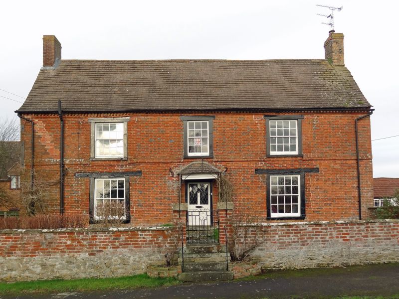
No. 17 Dairy Farmhouse
II
Farmhouse. C18. Brick, with concrete slate roof. 2 storeys, 3
wide bays. Central through stair hall. Half-glazed door with
moulded canopy. Early C19 16-pane sashes with heavy timber lintels
and raised surrounds. 12-pane window over door. Plat band and
brick-on-edge dentilled eaves. Gable stacks, rebuilt. Stone and
brick 2-bay rear wing on right with timber stair to attic level.
Listing NGR: SU0901790532
External links are from the relevant listing authority and, where applicable, Wikidata. Wikidata IDs may be related buildings as well as this specific building. If you want to add or update a link, you will need to do so by editing the Wikidata entry.


Other nearby listed buildings