Approximate Location Map
Large Map »
Latitude: 51.6116 / 51°36'41"N
Longitude: -1.7446 / 1°44'40"W
OS Eastings: 417782
OS Northings: 190343
OS Grid: SU177903
Mapcode National: GBR 4TQ.XDC
Mapcode Global: VHB37.QR2D
Plus Code: 9C3WJ764+M5
Entry Name: North Farmhouse
Listing Date: 20 September 1979
Grade: II
Source: Historic England
Source ID: 1023413
English Heritage Legacy ID: 318545
ID on this website: 101023413
Location: Stanton Fitzwarren, Swindon, Wiltshire, SN6
County: Swindon
Civil Parish: Stanton Fitzwarren
Traditional County: Wiltshire
Lieutenancy Area (Ceremonial County): Wiltshire
Church of England Parish: Stanton Fitzwarren
Church of England Diocese: Bristol
Tagged with: Farmhouse
1.
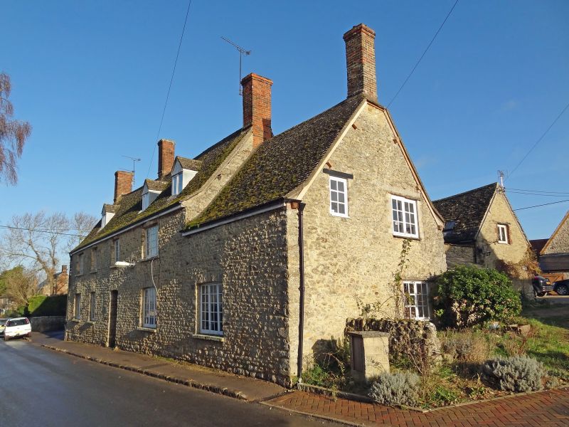
5410 STANTON FITZWARREN TRENCHARD ROAD
(north-east side)
North Farmhouse
SU 19 SE 5/440
II
2.
Late C18. Two and a half storeys rubble with modern tile roof slightly tented
as base. Four brick chimneys. Four bays of 2 light casements with glazing
bars and cambered heads, outer windows of 5-lights. Door off-centre right.
Three gabled dormers. One window extension to right.
Listing NGR: SU1778290343
External links are from the relevant listing authority and, where applicable, Wikidata. Wikidata IDs may be related buildings as well as this specific building. If you want to add or update a link, you will need to do so by editing the Wikidata entry.


Other nearby listed buildings
