Approximate Location Map
Large Map »
Latitude: 51.5431 / 51°32'35"N
Longitude: -1.7026 / 1°42'9"W
OS Eastings: 420721
OS Northings: 182736
OS Grid: SU207827
Mapcode National: GBR 4VR.8C0
Mapcode Global: VHC13.FGRW
Plus Code: 9C3WG7VW+7X
Entry Name: The Whitehouse
Listing Date: 20 September 1979
Grade: II
Source: Historic England
Source ID: 1023421
English Heritage Legacy ID: 318572
ID on this website: 101023421
Location: Upper Wanborough, Swindon, Wiltshire, SN4
County: Swindon
Civil Parish: Wanborough
Built-Up Area: Wanborough
Traditional County: Wiltshire
Lieutenancy Area (Ceremonial County): Wiltshire
Church of England Parish: Lyddington and Wanborough
Church of England Diocese: Bristol
Tagged with: Building Thatched cottage
1.
5410 WANBOROUGH CHURCH ROAD
(north side)
Upper Wanborough
No 46 The Whitehouse
SU 2082 25/487
II
2.
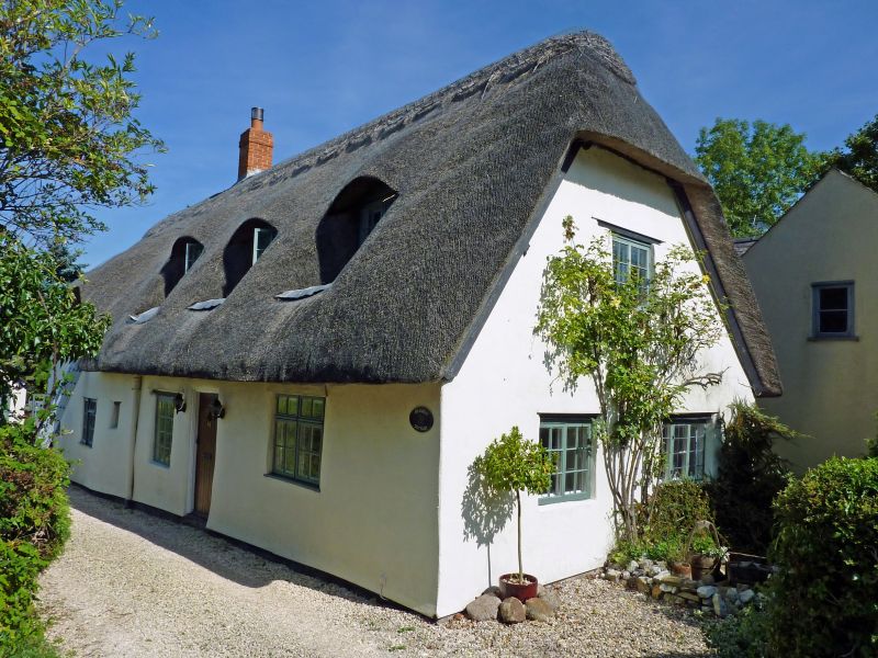
Probably C18, possibly older. One and a half storey thatched cottage. Gable
end quarter hipped (and with 2 pheasants) to road. This end has a 2 light
casement on first floor and 2 windows on ground floor (2 and 3 light casements).
Brick and stone chimney at north end.
East front has 2 eyebrow dormers, one has 3 light casement window with ovolo
wooden mullions. Central 6 panel door. Glazing bar sash to right. Four
light casement window to north-west with ovolo section wooden mullions.
Interior retains a good example of an inglenook fireplace with salt cupboard
and blocked bread oven. Stop chamfered main beam.
Listing NGR: SU2072182736
External links are from the relevant listing authority and, where applicable, Wikidata. Wikidata IDs may be related buildings as well as this specific building. If you want to add or update a link, you will need to do so by editing the Wikidata entry.


Other nearby listed buildings
