Latitude: 51.0662 / 51°3'58"N
Longitude: -1.7948 / 1°47'41"W
OS Eastings: 414477
OS Northings: 129669
OS Grid: SU144296
Mapcode National: GBR 51F.31K
Mapcode Global: FRA 7649.DMC
Plus Code: 9C3W3684+F3
Entry Name: 18, the Close
Listing Date: 28 February 1952
Grade: II*
Source: Historic England
Source ID: 1023594
English Heritage Legacy ID: 318986
ID on this website: 101023594
Location: The Friary, Wiltshire, SP1
County: Wiltshire
Civil Parish: Salisbury
Built-Up Area: Salisbury
Traditional County: Wiltshire
Lieutenancy Area (Ceremonial County): Wiltshire
Tagged with: Building
THE CLOSE 1. 1594 No 18 SU 1429 NW 3/43 28.2.52. II* GV
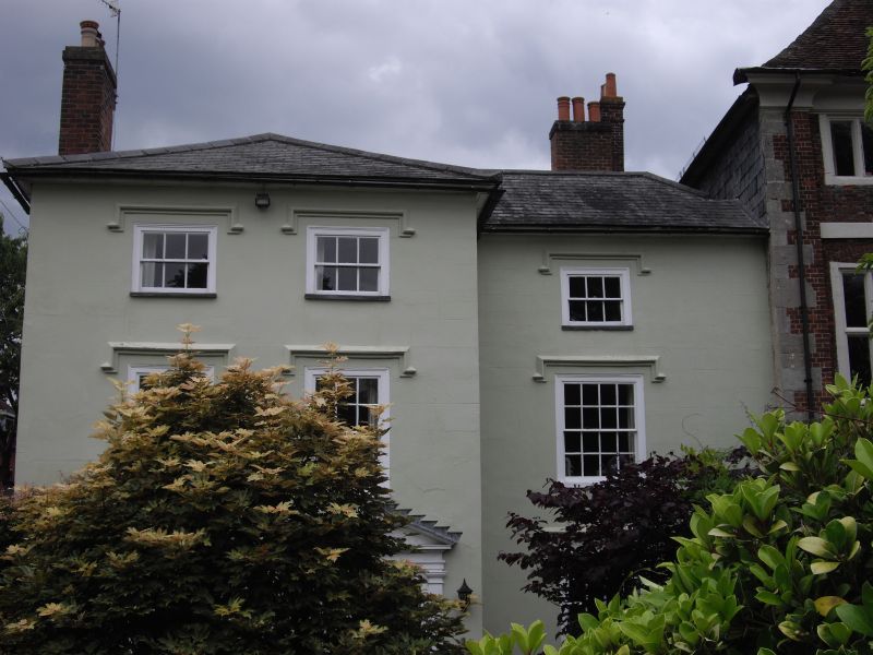
2. Originally Common Hall of the Vicars Choral, early canonical house (bequeathed 1319-20) of which these are some remains. The front part of house recased and heightened in the early C19. 3 storeys, stucco faced. Flat eaves to hipped slate roof. Unsymnmetrical front with projecting L H wing. Entrance below road level. 2 windows to upper floors. 1 window on ground floor and 6-panel door at R H with panelled reveals and doorcase of Doric pilasters simplified entablature and moulded pediment. The R H part has 1 window 3 panes wide on second floor and 4 panes wide first and ground floors. All windows have drip moulds. To rear early ruing 2 storeys tile hung with gable end old tile roof, restored, mostly C16/Cl7 but the west wall has section of original material, flint stone, rubble and diagonally set tiles. The wing has some exposed beams 2 bays of roof structure with intact windbraces and purlins, one collar.
All the listed buildings in The Close form an outstanding group.
Listing NGR: SU1447629669
External links are from the relevant listing authority and, where applicable, Wikidata. Wikidata IDs may be related buildings as well as this specific building. If you want to add or update a link, you will need to do so by editing the Wikidata entry.


Other nearby listed buildings