Latitude: 51.0694 / 51°4'9"N
Longitude: -1.7997 / 1°47'58"W
OS Eastings: 414131
OS Northings: 130022
OS Grid: SU141300
Mapcode National: GBR 517.V4H
Mapcode Global: FRA 7639.BP7
Plus Code: 9C3W3692+P4
Entry Name: 38 and 40, Fisherton Street
Listing Date: 12 October 1972
Last Amended: 13 May 1980
Grade: II
Source: Historic England
Source ID: 1023668
English Heritage Legacy ID: 319137
ID on this website: 101023668
Location: Salisbury, Wiltshire, SP2
County: Wiltshire
Civil Parish: Salisbury
Built-Up Area: Salisbury
Traditional County: Wiltshire
Lieutenancy Area (Ceremonial County): Wiltshire
Church of England Parish: Salisbury St Thomas and St Edmund
Church of England Diocese: Salisbury
Tagged with: Building
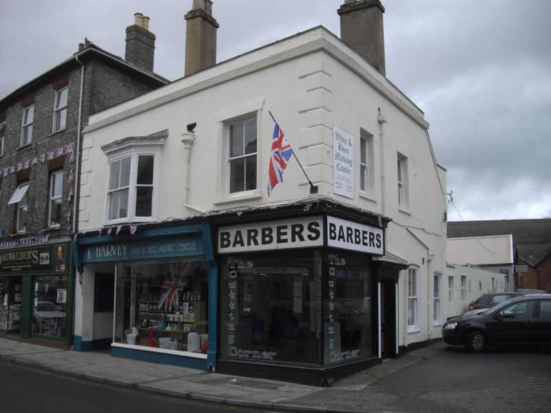
FISHERTON STREET
1.
1594
(North Side)
No 40
SU 1430 SW 1/464
II
2.
Late C19 brick front of 3 storeys, 2 windows, modern shop, concealing C16
timber framed building. Originally had 2 gables to street with upper floor
jettied. Rear wing formerly main house, gable Just visible, slate hung lst
floor. North room has C16 moulded ceiling beams. C17 panelling, Arched
brace collar roof, tie beams, Flat arched fireplaces.
Listing NGR: SU1413130021
External links are from the relevant listing authority and, where applicable, Wikidata. Wikidata IDs may be related buildings as well as this specific building. If you want to add or update a link, you will need to do so by editing the Wikidata entry.


Other nearby listed buildings