Approximate Location Map
Large Map »
Latitude: 52.1072 / 52°6'25"N
Longitude: -1.4618 / 1°27'42"W
OS Eastings: 436954
OS Northings: 245567
OS Grid: SP369455
Mapcode National: GBR 6QR.WRP
Mapcode Global: VHBYJ.M91G
Plus Code: 9C4W4G4Q+V7
Entry Name: Kitchen Garden South Traverse Wall at Upton House
Listing Date: 8 April 1987
Grade: II
Source: Historic England
Source ID: 1024177
English Heritage Legacy ID: 306246
ID on this website: 101024177
Location: Sun Rising, Stratford-on-Avon, Warwickshire, OX15
County: Warwickshire
District: Stratford-on-Avon
Town: Stratford-on-Avon
Civil Parish: Ratley and Upton
Traditional County: Warwickshire
Lieutenancy Area (Ceremonial County): Warwickshire
Church of England Parish: Ratley St Peter ad Vincula
Church of England Diocese: Coventry
Tagged with: Building
RATLEY AND UPTON UPTON
SP34NE
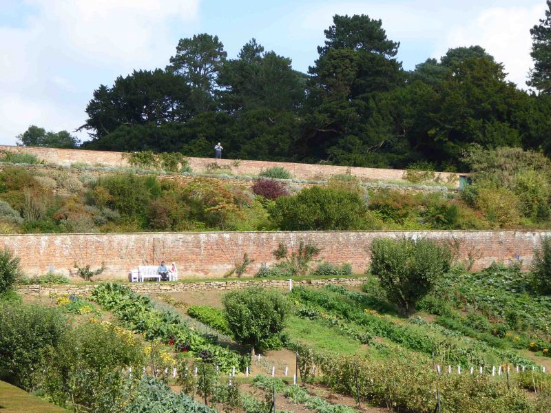
3/135 Kitchen garden S transverse
wall at Upton House
GV II
Garden wall, Late C17/early C18. Red Flemish bond brick with moulded stone
coping.
Listing NGR: SP3695445567
External links are from the relevant listing authority and, where applicable, Wikidata. Wikidata IDs may be related buildings as well as this specific building. If you want to add or update a link, you will need to do so by editing the Wikidata entry.


Other nearby listed buildings
