Latitude: 51.452 / 51°27'7"N
Longitude: -2.5541 / 2°33'14"W
OS Eastings: 361595
OS Northings: 172708
OS Grid: ST615727
Mapcode National: GBR CKL.7B
Mapcode Global: VH88N.PR4Q
Plus Code: 9C3VFC2W+R9
Entry Name: Netham Locks, Including Remains of Bridge
Listing Date: 11 July 1990
Last Amended: 30 December 1994
Grade: II
Source: Historic England
Source ID: 1025059
English Heritage Legacy ID: 379567
ID on this website: 101025059
Location: Netham, Bristol, BS2
County: City of Bristol
Electoral Ward/Division: Lawrence Hill
Parish: Non Civil Parish
Built-Up Area: Bristol
Traditional County: Gloucestershire
Lieutenancy Area (Ceremonial County): Bristol
Church of England Parish: East Bristol St Ambrose and St Leonard
Church of England Diocese: Bristol
BRISTOL
ST6172 FEEDER ROAD, Netham 901-1/43/1624 (North side) 11/07/90 Netham Locks, including remains of bridge (Formerly Listed as: FEEDER ROAD, Netham Netham Lock and Bridge)
GV II
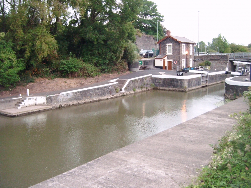
Lock. c1809. By William Jessop. Squared Pennant stone, and timber lock gates. Splayed entrances to the lock, lock walls rebated to house the 2 sets of lock gates, and abutments between them for the canal bridge over the lock. The west side of the bridge, with a coped parapet wall, survives, and the ramped path up to the bridge from the east of the Feeder Road side. Angled granite setts for the higher swing gates. Netham Lock is the entrance to the Feeder Canal and the Floating Harbour, designed and built by William Jessop in 1804-9. (Lord J and Southam J: The Floating Harbour: Bristol: 1983-: 36).
Listing NGR: ST6159572708
External links are from the relevant listing authority and, where applicable, Wikidata. Wikidata IDs may be related buildings as well as this specific building. If you want to add or update a link, you will need to do so by editing the Wikidata entry.


Other nearby listed buildings