Latitude: 51.4676 / 51°28'3"N
Longitude: -2.5756 / 2°34'32"W
OS Eastings: 360111
OS Northings: 174449
OS Grid: ST601744
Mapcode National: GBR CDD.DR
Mapcode Global: VH88N.9CQS
Plus Code: 9C3VFC9F+2Q
Entry Name: 12-18, Jubilee Road
Listing Date: 30 December 1994
Grade: II
Source: Historic England
Source ID: 1025266
English Heritage Legacy ID: 379846
ID on this website: 101025266
Location: Montpelier, Bristol, BS2
County: City of Bristol
Electoral Ward/Division: Ashley
Parish: Non Civil Parish
Built-Up Area: Bristol
Traditional County: Gloucestershire
Lieutenancy Area (Ceremonial County): Bristol
Church of England Parish: Bristol St Paul's
Church of England Diocese: Bristol
Tagged with: Building
BRISTOL
ST6074 JUBILEE ROAD, St Werburgh 901-1/37/1930 (East side) Nos.12-18 (Even)
II
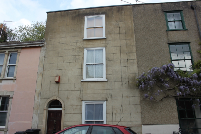
Terrace of 4 houses. Early C19. Render with limestone dressings, brick party wall stacks and pantile roof. Double-depth plan. Late Georgian style. Each of 3 storeys and basement; 1-window range. 2 pairs of houses with outer doorways and coped parapets; semicircular-arched doorways with keys and imposts, plate-glass fanlights and 6-panel doors. Sashes in exposed frames, No.16 with recessed frames, with 6/6-pane and plate-glass sashes. No.12 reduced to 2 storeys. Rear elevations are 2 storeys. INTERIOR: No.12, entrance hall with semicircular arch to a dogleg stair with column newels, ramped rail and stick balusters, winder stair to second floor, stone fireplaces, flagged basement, and 6-panel doors. Shown on Ashmead's 1826 map; the Jubilee referred to may be that of 1810.
Listing NGR: ST6011174449
External links are from the relevant listing authority and, where applicable, Wikidata. Wikidata IDs may be related buildings as well as this specific building. If you want to add or update a link, you will need to do so by editing the Wikidata entry.


Other nearby listed buildings