Latitude: 55.0175 / 55°1'3"N
Longitude: -1.4261 / 1°25'34"W
OS Eastings: 436792
OS Northings: 569368
OS Grid: NZ367693
Mapcode National: GBR LBHF.15
Mapcode Global: WHD4S.245V
Plus Code: 9C7W2H9F+2H
Entry Name: 5 and 6, Dawson Square
Listing Date: 19 February 1986
Grade: II
Source: Historic England
Source ID: 1025370
English Heritage Legacy ID: 303301
ID on this website: 101025370
Location: Tynemouth, North Tyneside, Tyne and Wear, NE30
County: North Tyneside
Electoral Ward/Division: Tynemouth
Parish: Non Civil Parish
Built-Up Area: Tynemouth
Traditional County: Northumberland
Lieutenancy Area (Ceremonial County): Tyne and Wear
Church of England Parish: Tynemouth Priory Holy Saviour
Church of England Diocese: Newcastle
Tagged with: Building
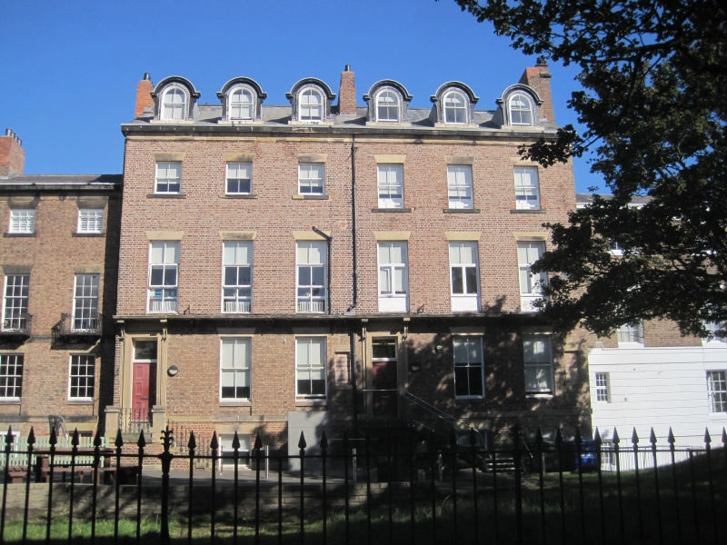
TYNEMOUTH DAWSON SQUARE (north side) NZ 3669 SE Tynemouth 9/55 Nos 5 and 6 G.V. II 2 houses. Circa 1860. English bond brick with ashlar plinth and dressings. Welsh slate roof. Basement, 3 storeys and attics. 3 and 3 bays. At left a door with large overlight in architrave under bracketed canopy; sash window inserted in similar opening in bay 4; door inserted in bay 6. Wedge stone lintels and projecting stone sills to ground and second floor sash windows; first floor sill band continuous with door canopy. Roof has 6 round-headed dormers, 2 end and one central brick chimneys. See also under nos 1 and 2 Huntington Place.
Listing NGR: NZ3679269368
External links are from the relevant listing authority and, where applicable, Wikidata. Wikidata IDs may be related buildings as well as this specific building. If you want to add or update a link, you will need to do so by editing the Wikidata entry.


Other nearby listed buildings