Latitude: 55.051 / 55°3'3"N
Longitude: -1.569 / 1°34'8"W
OS Eastings: 427633
OS Northings: 573030
OS Grid: NZ276730
Mapcode National: GBR KBH1.34
Mapcode Global: WHC3C.W91N
Plus Code: 9C7W3C2J+C9
Entry Name: Burradon Tower (East of Burradon House)
Listing Date: 27 February 1950
Grade: II
Source: Historic England
Source ID: 1025387
English Heritage Legacy ID: 303247
ID on this website: 101025387
Location: Burradon, North Tyneside, Tyne and Wear, NE23
County: North Tyneside
Electoral Ward/Division: Camperdown
Parish: Non Civil Parish
Traditional County: Northumberland
Lieutenancy Area (Ceremonial County): Tyne and Wear
Church of England Parish: Weetslade
Church of England Diocese: Newcastle
This list entry was subject to a Minor Amendment on 10 November 2025 to reformat the text to current standards
NZ 27 SE
3/2
LONGBENTON
BURRADON ROAD (east side, off)
Burradon Tower, east of Burradon House.
27.2.50
II
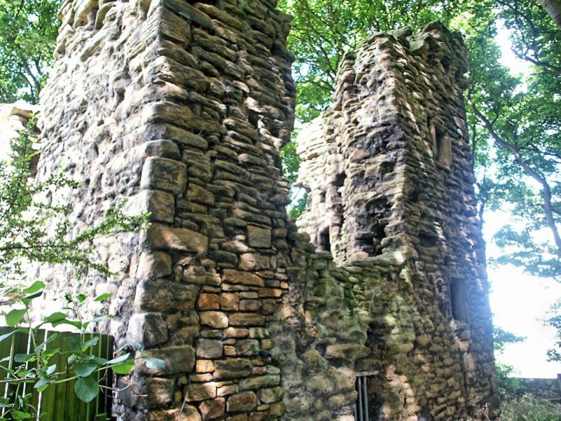
Tower house. Mid C16. Sandstone rubble with long quoins. Square plan, one bay; basement and two floors. Chamfered surround to elliptical-headed doorway on east elevation; slit window above at right. Left return has inserted doorway with wood jambs and lintel beneath stone lintel; sill of three-light stone-mullioned window at first floor; two small square windows at right on first and second floors; fragments of corbel table and parapet with machicolation, on three deep corbels, above east door. Ruinous at time of survey.
Interior not inspected.
Source: H.E. Craster Northumberland County History vol. IX The Parochial Chapelries of Earsdon and Horton 1909 pp 46-49.
Listing NGR: NZ2763373030


Other nearby listed buildings