Approximate Location Map
Large Map »
Latitude: 55.051 / 55°3'3"N
Longitude: -1.569 / 1°34'8"W
OS Eastings: 427633
OS Northings: 573030
OS Grid: NZ276730
Mapcode National: GBR KBH1.34
Mapcode Global: WHC3C.W91N
Plus Code: 9C7W3C2J+C9
Entry Name: Burradon Tower (East of Burrandon House)
Listing Date: 27 February 1950
Grade: II
Source: Historic England
Source ID: 1025387
English Heritage Legacy ID: 303247
ID on this website: 101025387
Location: Burradon, North Tyneside, Tyne and Wear, NE23
County: North Tyneside
Electoral Ward/Division: Camperdown
Parish: Non Civil Parish
Traditional County: Northumberland
Lieutenancy Area (Ceremonial County): Tyne and Wear
Church of England Parish: Weetslade
Church of England Diocese: Newcastle
LONGBENTON BURRADON ROAD (east
NZ 27 SE
side, off)
Burradon
3/2
Burradon Tower, east
27.2.50 of Burradon House.
II
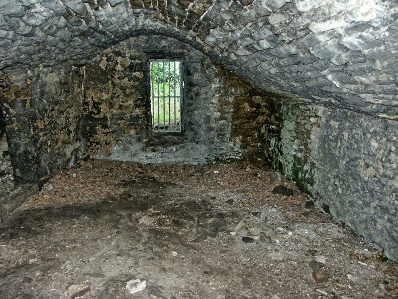
Tower house. Mid C16. Sandstone rubble with long quoins. Square plan, one bay;
basement and 2 floors. Chamfered surround to elliptical-headed doorway on east
elevation; slit window above at right. Left return has inserted doorway with
wood jambs and lintel beneath stone lintel; sill of 3-light stone-mullioned
window at first floor; 2 small square windows at right on first and second
floors; fragments of corbel table and parapet with machicolation, on 3 deep
corbels, above east door. Ruinous at time of survey. Interior not inspected.
Source: H.E. Craster Northumberland County History vol. IX The Parochial
Chapelries of Earsdon and Horton l9O9 pp 46-49.
Listing NGR: NZ2763373030
External links are from the relevant listing authority and, where applicable, Wikidata. Wikidata IDs may be related buildings as well as this specific building. If you want to add or update a link, you will need to do so by editing the Wikidata entry.


Other nearby listed buildings
