Approximate Location Map
Large Map »
Latitude: 50.987 / 50°59'13"N
Longitude: -0.7327 / 0°43'57"W
OS Eastings: 489045
OS Northings: 121610
OS Grid: SU890216
Mapcode National: GBR DF3.1KS
Mapcode Global: FRA 96CH.LCS
Plus Code: 9C2XX7P8+RW
Entry Name: The Former Stables of Old Cowdray House
Listing Date: 18 June 1959
Grade: II
Source: Historic England
Source ID: 1026037
English Heritage Legacy ID: 301631
ID on this website: 101026037
Location: Midhurst, Chichester, West Sussex, GU29
County: West Sussex
District: Chichester
Town: Chichester
Civil Parish: Easebourne
Traditional County: Sussex
Lieutenancy Area (Ceremonial County): West Sussex
Church of England Parish: Easebourne St Mary
Church of England Diocese: Chichester
Tagged with: Building
SU 82 SE EASEBOURNE EASEBOURNE LANE
11/60 The former Stables of Old
18.6.59 Cowdray House
II
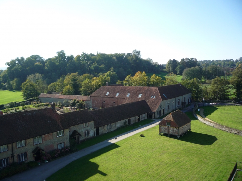
Stables, now a farm building. Built by Anthony, Sixth Viscount Montague, in 1726.
Half H-plan, the wings being of unequal length. Stone rubble. Modillion eaves
cornice, hipped tiled roof. The north west wing, originally the coach-house has
two round-headed archway with keystones and two tall sash windows with glazing bars.
Listing NGR: SU8904521610
External links are from the relevant listing authority and, where applicable, Wikidata. Wikidata IDs may be related buildings as well as this specific building. If you want to add or update a link, you will need to do so by editing the Wikidata entry.


Other nearby listed buildings
