Latitude: 50.8624 / 50°51'44"N
Longitude: -0.9261 / 0°55'34"W
OS Eastings: 475673
OS Northings: 107542
OS Grid: SU756075
Mapcode National: GBR CDW.SSY
Mapcode Global: FRA 86YT.H0M
Plus Code: 9C2XV36F+XH
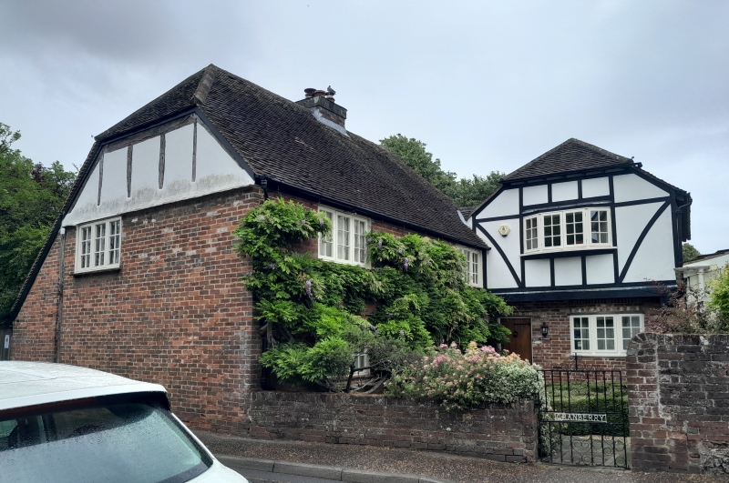
Entry Name: Cranberry
Listing Date: 28 January 1986
Grade: II
Source: Historic England
Source ID: 1026136
English Heritage Legacy ID: 301366
ID on this website: 101026136
Location: Westbourne, Chichester, West Sussex, PO10
County: West Sussex
District: Chichester
Civil Parish: Westbourne
Built-Up Area: Emsworth
Traditional County: Sussex
Lieutenancy Area (Ceremonial County): West Sussex
Church of England Parish: Westbourne St John the Baptist
Church of England Diocese: Chichester
Tagged with: Building
WESTBOURNE NORTH STREET
SU 7407-7507 (east side)
24/463 Cranberry
-
- II
L-shaped building. West wing C18. Two storeys. Two windows. Red brick.
Tiled roof. Casement windows. South east wing later addition in imitation
timbering.
Listing NGR: SU7567307542
External links are from the relevant listing authority and, where applicable, Wikidata. Wikidata IDs may be related buildings as well as this specific building. If you want to add or update a link, you will need to do so by editing the Wikidata entry.


Other nearby listed buildings