Approximate Location Map
Large Map »
Latitude: 50.843 / 50°50'34"N
Longitude: -0.9135 / 0°54'48"W
OS Eastings: 476596
OS Northings: 105390
OS Grid: SU765053
Mapcode National: GBR CF8.3VQ
Mapcode Global: FRA 86ZW.1YS
Plus Code: 9C2XR3VP+5J
Entry Name: Mons House
Listing Date: 28 January 1986
Grade: II
Source: Historic England
Source ID: 1026180
English Heritage Legacy ID: 301268
ID on this website: 101026180
Location: Prinsted, Chichester, West Sussex, PO10
County: West Sussex
District: Chichester
Civil Parish: Southbourne
Built-Up Area: Emsworth
Traditional County: Sussex
Lieutenancy Area (Ceremonial County): West Sussex
Church of England Parish: Southbourne St John the Evangelist
Church of England Diocese: Chichester
Tagged with: House
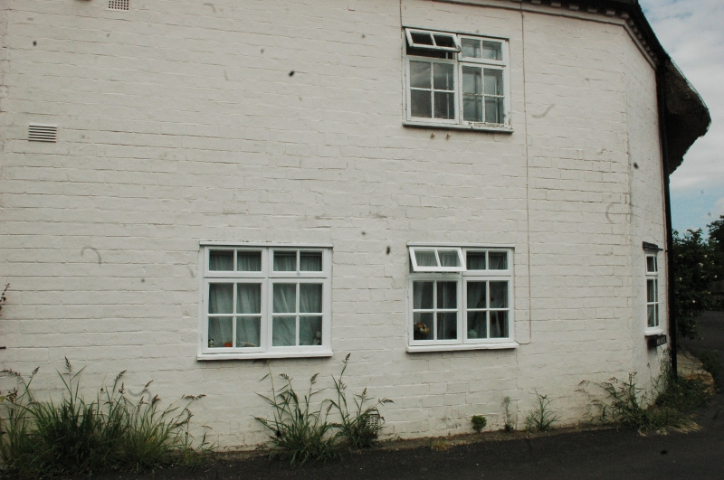
SOUTHBOURNE PRINSTED LANE, PRINSTED
SU 7605/7705 (north west arm)
27/504 Mons House
-
GV II
Early C19 with splayed angle to the front. Two storeys. Three windows.
Faced with brick in rat-trap bond, now painted. Eaves modillion cornice.
Slate roof. Modern casement windows. Included for group value.
Listing NGR: SU7659605390
External links are from the relevant listing authority and, where applicable, Wikidata. Wikidata IDs may be related buildings as well as this specific building. If you want to add or update a link, you will need to do so by editing the Wikidata entry.


Other nearby listed buildings
